 |
The Tuesday Night Club Official Web Site |
The Tuesday Night Club on Tour
Tour 2006
4 - Dartford Creek, inc upper river and Cray Arm. Gravesend Basin.
The first creek tackled was the most difficult to reach,
the River Darent and Cray, which once formed the Dartford and Crayford
Navigation. This was planned to coincide with the early April Spring tide, as we
would need the tidal range! Near the end of Dartford Creek, just before the
paper mills is a derelict lock. Up until the mid 1980’s this was functional,
but with no commercial traffic after that date the gates were chained back and
the pound above to the paper mills was allowed to be tidal.
A stop plank dam had been installed at the head of the lock
to attempt to retain some water in this muddy creek, further impending
navigation. Just before the present head of navigation, a dropped road bridge
was an intact but inoperative lift footbridge. A reccy was taken to check this
bridge height at a tide level where it was just possible to get over the disused
lock dam (this has a tide gauge giving the draught over the stop planks). The
result was that it looked like it would be possible to make a very quick trip
under and quickly back from the footbridge!
As was our usual plan we chose a morning tide that was just
before high Springs (the theory being that if you got stuck the next tide would
be higher to float you off). Departure was from Brentford at high water, the
plan being to run down on the ebb, all the way through London to the QE2 Bridge
and mill about (there would not be any serious commercial craft activity at low
water) then beach Earnest at the entrance to Dartford Creek and run up on the
first of the flood.
This worked out OK, a quick detour was made at Limehouse,
we went back to the lock entrance to pick up Martin Ludgate and Steve Haywood,
who were itching to become Honorary TNC Members (actually they probably wanted
to save themselves the bother of going to Dartford Creek!) It was interesting to
note that the 58ft 6ins Earnest just managed to wind in the entrance to the new
Limehouse Lock; a 60ft narrowboat would not have managed it and would have had
an “interesting” reverse out into the strong ebb tide.
We got down to Dartford around 10:30, a 4.5 hour leisurely
trip down. After milling about the tide eventually changed and we beached
Earnest in the silt at the entrance to Dartford Creek. Around 13:30 we started
the gentle passage up Dartford Creek, stopping many times on the silty bottom.
Come 14:45 we had managed to wind in the paper mill drain outfall just below
Dartford Lock and managed to reverse into the chamber. The official S.P.C.C.
guide then tells you to high tail it back down Dartford Creek, with a quick
detour up the Cray Arm (River Cray), then back up the Thames using as much of
the remaining flood as possible.
TNC were made of sterner stuff and we hang around in the
lock chamber until there was just enough water over the cill dam to enable
passage. It was a quick reverse up to the first unexpected obstacle. This was a
removed lift bridge narrows, passage was barred by a piece of side fendering
that was only hanging on by one upstream bolt, the incoming tide having pushed
it across as a barrier! After much to-ing and fro-ing, use of poles and boat
hooks we got past this obstruction and just managed a quick passage under the
disused swing footbridge.
In the excitement poor old Peter Wright had got left
behind, at least we had some good from the land shots of the proceedings. After
picking Peter up we then went full steam back down Dartford Creek, already
looking rather different now nearly full of water. The new by-pass bridge as
predicted posed no problem (about 2ft clearance).
We quickly traversed the Cray arm but had to mess around
with trees that had grown up covering the entrance to the basin. We did a very
quick photo call here, we managed an easy wind, as it was approaching high
water.
After a hasty passage past the trees (there was no time for
a chainsaw tidy!) it was hell for leather to gain the last of the flood tide.
Dartford Creek now looked completely different, the spring tide had spread over
the sides of the muddy ditch we had entered by making it look much more
attractive.
It was difficult to find the entrance channel at the mouth
with the Thames, we just steered the approximate route we had taken on the way
in. With the flood tide easing off we managed to get to around Ford’s at
Dagenham before the ebb tide started. It was now a real slog, especially through
the restriction where the Woolwich ferries cross, but surprisingly not through
the Thames Flood Barrier. We had booked a late 20:00 arrival at Limehouse, but
due to our delay in getting to the head of navigation of Dartford Creek we
arrived back some 20 minutes late.
Beached on the spit at the entrance to Dartford Creek, waiting for the flood
tide.

As soon as there is enough water we enter Dartford Creek and follow the flood
tide up.

Looking back at the entrance to Dartford Creek.

The Environment Agency flood barrier at the entrance to Dartford Creek.

We make pass under the EA flood barrier. Dartford Creek.

Dartford Creek, somewhat early on the flood tide.

Dartford Creek (River Darent). The Cray Arm of the Dartford and Crayford
Navigation (River Cray) comes in from the right.

The new A206 Bob Dunn Way Bridge.

The A206 Bob Dunn Way Bridge at low water.

Portable air draught marker under A206 Bob Dunn Way Bridge. From an explo day
out.

Martin Ludgate and Steve Haywood finally make it as TNC Honorary Members.

Dartford Creek at low water - lovely!

The Arjo Wiggins paper mills dominate the end of Dartford Creek.

Paper mills beside Dartford Creek.

Paper mills by Dartford Creek. From an explo day out.

Dartford Lock at low water, Dartford Creek. From an explo day out.

Dartford Lock and the "winding point" at low water, Dartford Creek.
From an explo day out.

The "winding point" at low water, Dartford Creek. From an explo day
out.

After winding we reverse back into the gateless lock. looking back downstream.

After winding we reverse back into the gateless lock.

Moored up in the gateless lock.

Moored up in the gateless lock. We wait for the flood tide to fill up the river
behind the leaky stop plank dam. Dartford Lock, Dartford Creek.

Moored up in the gateless lock. We wait for the flood tide to fill up the river
behind the leaky stop plank dam. Dartford Lock, Dartford Creek.

Looking up from the disused Dartford Lock at low water. From an explo day out.

Moored up in the gateless lock. We wait for the flood tide to fill up the river
behind the leaky stop plank dam. Dartford Lock, Dartford Creek.

Waiting in Dartford Lock - nearly there!

The disused lift bridge narrows at low water. From an explo day out.

Upper Dartford Creek at low water. From an explo day out.

Dartford Lock at low water. From an explo day out.

Dartford Lock at low water. From an explo day out.

Dartford Lock at low water. From an explo day out.

Dartford Lock at low water. From an explo day out.

Dartford Lock at low water. From an explo day out.

Dartford Lock at low water. From an explo day out.

Dartford Lock at low water. From an explo day out.

Dartford Lock at low water. Notice the depth gauge for water level over the
impounding cill. From an explo day out.

The impounding cill gauge on Dartford Lock.
Looking up from Dartford Lock.
We pass over the cill dam and reverse up the upper river. Dartford Creek.
We meet an obstruction in the old lift bridge narrows. This old bump bar had
pivoted from the upstream end and was a bugger to get out of the way. Upper
River. Dartford Creek.
Once through the old lift bridge narrows the old wooden bump bar is forced back
by the flood tide.
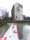
With just enough headroom we attempt to navigate under the disused lift
footbridge, just downstream of the fixed bridge...

The disused foot lift bridge at low water. From an explo day out.

The disused foot lift bridge at low water. From an explo day out.

The disused foot lift bridge at low water. From an explo day out.
We just make it under the disused foot lift bridge. Upper River, Dartford Creek.

Beyond the disused foot lift bridge is a fixed low bridge. Upper River. Dartford
Creek.

The fixed low bridge at low water. Upper River. Dartford Creek.

After our passage under the disused lift foot bridge we go full tilt to enable a
quick trip up the Cray Arm before high water.

Coming back down the Upper River. Dartford Creek.

Upper River at low water. Dartford Creek.

We nudge the wooden bump bar out of the way. Upper River. Dartford Creek.

Upper River at high water. Dartford Creek.

Upper River at high water. Dartford Creek.

Dartford Lock at high water. Dartford Creek.

We now steam downstream against the last of the flood tide. Dartford Creek.

Looking back at Dartford Lock.

Looking back, showing our wake against the last of the high springs flood tide.

Just enough clearance under the A206 Bob Dunn Way Bridge. Dartford Creek.

The Cray Arm. From an explo day out.

The Cray Arm. From an explo day out.

Powering up the Cray Arm. Dartford and Crayford Navigations.

Powering up the Cray Arm. Dartford and Crayford Navigations.

The Cray Arm. From an explo day out.

The Cray Arm. From an explo day out.

The Cray Arm. Junction with the two basins. From an explo day out.

The Cray Arm. We are about to enter the main northern basin, through the fallen
tree to the right! Dartford and Crayford Navigations.

The Cray Arm. The main northern basin. Dartford and Crayford Navigations.

The Cray Arm. The main northern basin. Dartford and Crayford Navigations.

The Cray Arm. The main northern basin. After a quick wind we retreat downstream.
Dartford and Crayford Navigations.

The Cray Arm, the southern basin arm that we did not visit. From an explo day
out.

The Cray Arm, the southern basin arm that we did not visit. From an explo day
out.

The Cray Arm, the southern basin arm that we did not visit. From an explo day
out.

The Cray Arm, the southern basin arm that we did not visit. From an explo day
out.

Powering down lower Dartford Creek as the flood tide dies away

Retreating down Dartford Creek.

Retreating down Dartford Creek.

Retreating down Dartford Creek with somewhat more water than when we entered!

Retreating down Dartford Creek.

Retreating down Dartford Creek. About to pass out under the EA flood barrier.

Retreating down Dartford Creek.

Once out in the Thames it is hell for leather to get as far as possible before
the ebb tide starts.
By the time we reach the Woolwich Ferry the ebb has started and we dice with in
impatient Woolwich Ferry.

View of the River Thames from Gravesend.

The entrance lock into Gravesend Basin, the upstream end of the moribund Thames
and Medway Canal.

Swing bridge over the entrance lock into Gravesend Basin.

Looking out from Gravesend Basin entrance lock.

The Thames and Medway Canal used to exit the basin through this narrows. In the
re-development of the basin it is proposed to reinstate this connection with a
short section of the canal.

The old entrance narrows. Gravesend Basin.

Entrance Lock. Gravesend Basin.

Looking out across the River Thames from Gravesend Basin.

The entrance to Gravesend Basin from the River Thames.
Home Page | "Earnest" | "Beatty" | Canal Restoration