 |
The Tuesday Night Club Official Web Site |
The Tuesday Night Club on Tour
Tour 2002
48 - Portishead to Bristol. Severn Estuary, Tidal River Avon and Bristol Floating Harbour.
Monday 19th August 2002
The earliest Portishead thought they could let us out was just after 13:00, so we ambled down at this time and soon got a green light at the lock. We we tied up at 13:15 on the floaty pontoon, the locked down, at 13:30 we exited into an absolute millpond of dead flat
sea, dull overcast day. We took no chances as we were early in the flood and did the whole trip up to Bristol on tickover,
swung right out to Avonmouth Signal Station, before hugging the Avon Channel, close to the dock wall.
At 15:00 we arrived at the waiting and open Cumberland Basin Entrance Lock up into Bristol Floating Harbour and
were locked straight up, exiting at 15:25. At 15:50 we were moored up on the Visitor Mooring pontoon at the
upstream corner of St Augustine's reach. A friendly mooring warden came along and
shooed off some kids cycling! on the pontoons and said that not to bother with getting mooring permit, if we were only stopping for a few days!!! Martin left soon afterwards, to
go home for a day to sort his website out. Neil had to leg it over to the station as Martin forgot his door keys! Neil had sad solo meal in deserted Pizza Hut that night.
Tuesday 20th August 2002
Noisy night with much car skidding the other side of St Augustine's Reach in the car park behind @ Bristol. The self destructing fridge had sorted itself out after a de-frost "re-boot" so Neil went and did a spot of shopping and whiled away some more time by getting some passport photos and washing the boat down. Martin Clark arrived back that evening.

A gloomy morning looking out from Portishead Marina.

Looking out from Portishead Marina new lock, built in the old dock lock chamber.

Portishead Marina lock radial gate.

Looking from the lock into Portishead Marina. The gate to the left is the
redundant one from the old Port entrance lock.

Portishead Marina entrance lock.

Portishead Marina has not yet filled the back of the old Portishead Dock. Much
new apartment building was in progress - on the site of the old power station.

Looking back at the marina from the end of Portishead Dock.

On our way back out of Portishead Marina.

Waiting for Portishead Marina Lock. The pontoon to the left is the diesel point.

Locking out of Portishead Marina, just as there was enough water.

Leaving Portishead Marina. Avonmouth in the distance. Because we are early in
the flood we just amble along in tick-over.

The end of the Portishead breakwater.

Looking across to Denny Island, Denny Shoal Cardinal Buoy and Firefly Buoy. The
channel is between these two buoys.

Royal Portbury Dock Breakwater and Avonmouth in the distance. The Green Buoy
marks Flatness Rocks and even a narrowboat at this state of the tide needs to go
round it.

Royal Portbury Dock entrance lock.

Royal Portbury Dock Breakwater

Coming up to Avonmouth. It is essential to go right up to the downstream
Breakwater lamp, then follow the breakwater in, up the River Avon, as there is a
gently shelving mud bank on the right at the entrance to the Avon.

Avonmouth - Turning in up the Avon.

Looking back at Avonmouth Breakwater. The buoy on the left marks the edge of the
mud bank. Tidal River Avon.

Coming up to the M 5 Bridge. Tidal River Avon.

Looking back at Avonmouth. Tidal River Avon.

The village of Pill on the right bank. Tidal River Avon.

Looking back at the M 5 Bridge. Tidal River Avon.

Sea Mills Creek. Tidal River Avon.

Start of the Clifton Gorge. Tidal River Avon.

Clifton Gorge. Tidal River Avon.

Clifton Gorge, first sight of the Clifton Suspension Bridge. Tidal River Avon.

Looking back down Clifton Gorge. Tidal River Avon.

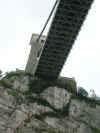
Clifton Suspension Bridge. Clifton Gorge. Tidal River Avon.

Looking back down Clifton Gorge. Tidal River Avon.

Clifton Suspension Bridge. Clifton Gorge. Tidal River Avon.

Hotwells, approach to the Floating Harbour. Tidal River Avon.

Cumberland Basin Entrance Lock. The new cut of the Tidal River Avon continues
up to the right.

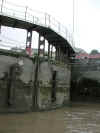
Cumberland Basin Entrance Lock. Bristol Floating Harbour.

Cumberland Basin Entrance Lock. Bristol Floating Harbour.

Detail of bottom gate. Cumberland Basin Entrance Lock. Bristol Floating Harbour.

Cumberland Basin Entrance Lock. Bristol Floating Harbour.

Cumberland Basin Entrance Lock. Bristol Floating Harbour.

Looking out of the Cumberland Basin Entrance Lock at the Plimsoll Swing Bridge.
Bristol Floating Harbour.

Cumberland Basin Entrance Lock Office. Bristol Floating Harbour.

Looking back at Cumberland Basin Entrance Lock. Bristol Floating Harbour.

Junction Lock Swing Bridge. Bristol Floating Harbour.

Harbour Masters Office in Underfall Yard.

Looking back at Junction Lock - now straight through. Bristol Floating Harbour.

Bristol Floating Harbour, looking back.

The Mathew Replica and SS Great Britain. Bristol Floating Harbour.

Looking back at the Maritime Heritage Centre. Bristol Floating Harbour.

Lloyds TSB Building. Bristol Floating Harbour.

Bristol Industrial Museum, on the far right bank. Bristol Floating Harbour.

St Augustine's Reach. Bristol Floating Harbour.

The end of St Augustine's Reach. Bristol Floating Harbour.

Visitor Moorings to the right on the corner of St Augustine's Reach. Bristol
Floating Harbour.
Home Page | "Earnest" | "Beatty" | Canal Restoration