
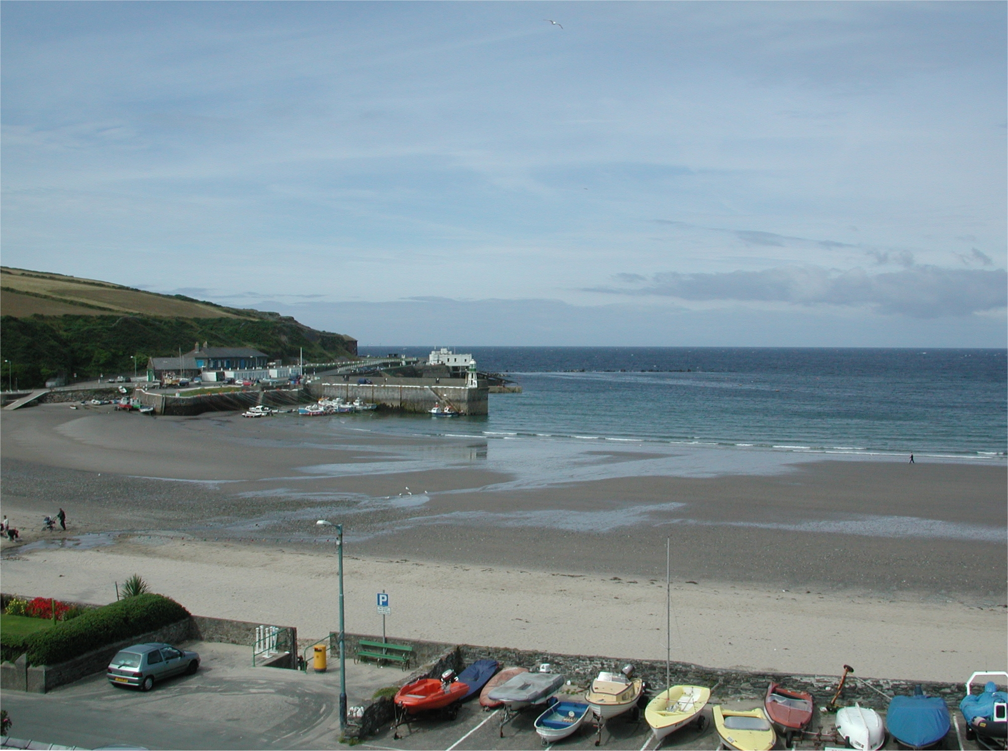
Ramsey, Isle Of Man.
Ocean Princess Scottish Tour
24/07/04
Neil and John had a rest day, but met up in the evening with John's mate from his Sealink days, Hamish Ross. Hamish just happens to now be the managing director of the IOM Steam packet Co! James and Robbie were spurred on by our railway travels, so they did the same thing this day.
25/07/04
Early start again, due to tides
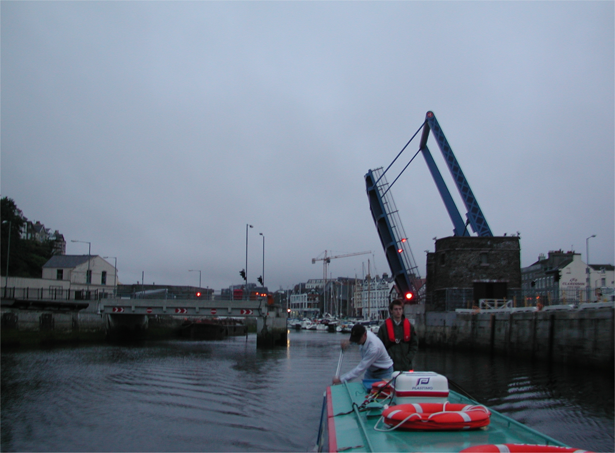
and wanting to clear the outer harbour before the 05:45 Seacat departure. The
lift bridge was swung on que at 05:00 and we were off, following a couple of
yachts and fishing boats. Rather calm seas all the way to Anglesey, we carried
on to just past South Stack, a good way off the island, to miss the sea lanes.
We then cut straight across the sea lanes and hugged the coast to miss out the
Irish Ferries ferry and Seacat departure from Holyhead to Dublin. Arrival at
Holyhead Marina was around 17:00 and after a move we were directed to the yottie
berth that did have a water point.
John used to be port manager at Holyhead and it was a bit of a trip down memory
lane, we found John's old house and he met up with his old child minder who gave
John a lift to Tesco's. James, Robbie and Neil went to the nearby pub and after
a reasonable meal settled down to a couple of rounds of Robbie's favourite card
game, Presidents and Ar$eholes! That evening John had his way with the local
yotties, finding out it was perfect conditions, tides and timings for a passage
round the island, up the Menai Straights and into the canal system via the River
Dee at Chester. John's good nature soon had a friendly yottie lending us the
Menai Straights chart and yacht club updates.
26/07/04
Civilised start time in the
gloomy mid morning. No wind and low misty clouds. It was so still we could even
pass close to South Stack lighthouse - we had to as it was so misty! Everything
went well, the bridges and the infamous "Swellies" rapids were passed
at low water (neaps). There was still a bit of a drop through the main section
of the Swellies where a series of rock islets block the straights. So out the
other side past Bangor and Beaumaris. Because we were in no hurry we took the
safer course round Puffin Island and then headed straight for the West Constable
marker, the start of the channel into the Dee and the Port of Mostyn.
The view into Conway was non-existent and even Llandudno could barely be made
out. The channel starts a fair way out in Liverpool Bay as the whole of the Dee
Estuary virtually dries out at LWS. A couple of coasters were passed coming out
of Mostyn. Arrival at Mostyn caused some concern, we had really run out of
flood, the channel markers beyond ran out (and yet strangely could be made out again
passed the old "Duke Of Lancaster" beached ferry!)........so we really
wanted to moor up at the dock (not really permitted) or take a chance on a
vacant buoy.
At that moment a RNLI rib arrived on a routine patrol. We were advised to take a
vacant buoy and they would go back to base, consult with locals for some local
knowledge and get back to us by mobile. The guys came good and after an hour had
foned back with the required information. We were to leave 2 hours before HW
Mostyn in the morning (06:00) and take a course some 20M off the training wall
side of the estuary until we reached the "Duke Of Lancaster", from
here we should head straight for the first red/white centre channel buoy.
Neil fretted a bit and stayed up to view the rather high shingle bar appearing
across the estuary. After judging some levels on the dock piles he retired for
the night.
27/07/04
Neil woke up around 04:30 to find
the shingle bar just covered on the Welsh landward side. A note of levels gave
us the guess of at least 3ft of water over the shingle bar when we shoved off
exactly at 06:00. It was delicate progress on tick over - but we were still
doing nearly 6 knots! Neil got the pole out and was worried to find the depth receding,
7ft, 6ft, then to just under 5ft until it started getting deeper again, By the
time we were back in channel the depth was off the end of the 8ft pole.
It was still gentle progress, seeing as we had to arrive at Chester about half
an hour before HW. All went well and once in the Dee Outfall proper, under the
Connah's Quay Bridges, we began to relax. Nearer Chester we did some more
poling, still only around 4ft of water! Arrival and the turn into the Dee locks
Branch was a gentle affair as the Neap flood had nearly gone off and the tidal
river would not make Chester Weir. So at 09:05 we were in the safety of the
inland waterway system.
Thanks go to BW Lengthsman Neville Preece for getting his lads out with only a
days notice to free up the silted bottom gates of the tidal lock. We were
probably the last boat to go up the Dee Locks Branch, last April when we went up
the Dee in Earnest.
It was no peace for the wicked, we had to get Ocean Princess back to Anderton
for the next afternoon, so it was straight on up Northgate locks and the Chester
Branch. Robbie left on the town outskirts and we cracked on until Chas Harden's.
Here we made ourselves at home after a diesel and water fill up. James washed
off the crusty salt deposits then we stripped off the front deck wash boards, emptied
the front "bike shed" and flushed this out.
After stowing everything tidily we set off again to get to Barbridge Junction
for a nice meal and pint in the Jolly Tar pub. The rest was short lived, because
that evening / night we did the Middlewich Arm / locks in Middlewich, getting to
below Big Lock at around 02:30 the next morning.
28/07/04
Start was around 08:00. About an hour of free boating until we picked up traffic. Arrival at Anderton Marina at about 11:15. Martin Clark had just arrived and walked down to meet us with another familiar figure - John Fletcher, IWA Chairman. John and Margaret had returned early from a spot of boating as John had a slot come up for his second eye operation. After Neil had done a spot of Hoovering and toilet cleaning Neil and Martin departed back to Martin's for the night......other than there was more boating in store, to help Ed Mortimer up the west side of the HNC!
Ramsey, Isle Of Man.

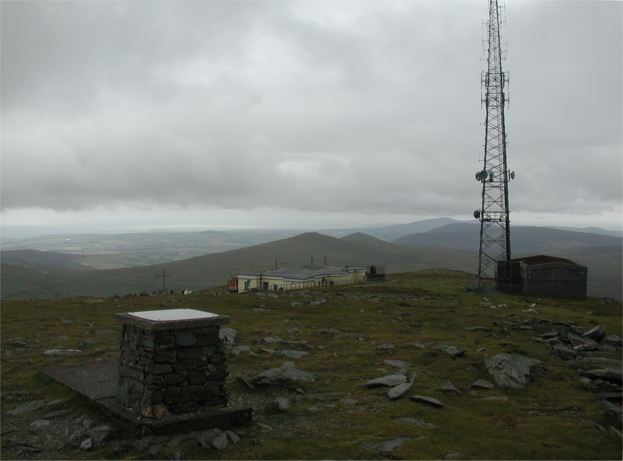
Snaefell. Isle Of Man.

Laxey. Isle Of Man.

Douglas Bay. Isle Of Man.

IOM Steam Packet Co Seacat exiting Douglas Harbour. Isle Of Man.

Heading into Douglas Harbour. Isle Of Man.

Douglas. Isle Of Man.

Douglas outer harbour. Isle Of Man.

IOM Steam Packet Co ferry Ben My Chree.

Ocean Princess waits in the outer dock for the tide to make the half tide weir
into the inner dock.

Looking across to the entrance to the inner harbour and the ferry berths.

The Ben leaves the outer harbour.

The sad remains of the Solway Harvester

IOM Steam Railway Douglas terminus.

IOM Steam Railway.

IOM Steam Railway. Port Erin Terminus. Note the brand new track. The section
here to has recently been re-opened following the completion of the under track
sewage mains construction.

IOM Steam Railway. DH Wood at rest at Port Erin.
Port Erin.

Port Erin station.

Douglas inner harbour.

Snaefell Mountain Railway tram car at Laxey.

Snaefell Mountain Railway. Snaefell summit terminus.
View from the top of Snaefell.

Laxey Station, joint Snaefell Mountain Railway and Manx Electric Railway.

Manx Electric Railway Ramsey Terminus.

Ocean Princess berthed in the inner harbour. Douglas Isle Of Man.

Ocean Princess berthed in the inner harbour. Note the half tide weir and lift
bridge.

Horse tram in Douglas.

Sea Terminal in Douglas.
Early morning departure from Douglas.

We follow the fishing boats out from Douglas harbour.

Seacat off South Stack, Holyhead Isle of Anglesey.

Approaches to Holyhead Harbour.

Lighthouse at the end of Holyhead breakwater.

Coming up the inside of the Holyhead breakwater towards the new Holyhead Marina.

Aluminium Ore unloading wharf. Holyhead.

Arrival at Holyhead Marina.

John Chapman outside his old house in Holyhead.

Ocean Princess berthed in Holyhead Marina.

South Stack Lighthouse. Not often like a millpond off here!

Llanddwyn Island, coming into Caernarfon Bay.

Menai Straights. Caernarfon.

Menai Straights. Caernarfon.

Menai Straights. Caernarfon.

Menai Straights.

Y Felinheli. Menai Straights.

Plas Newydd. Menai Straights.

Britannia Bridge. Since the tubular spans were damaged by fire, this is now a
double deck road / rail bridge. Menai Straights.
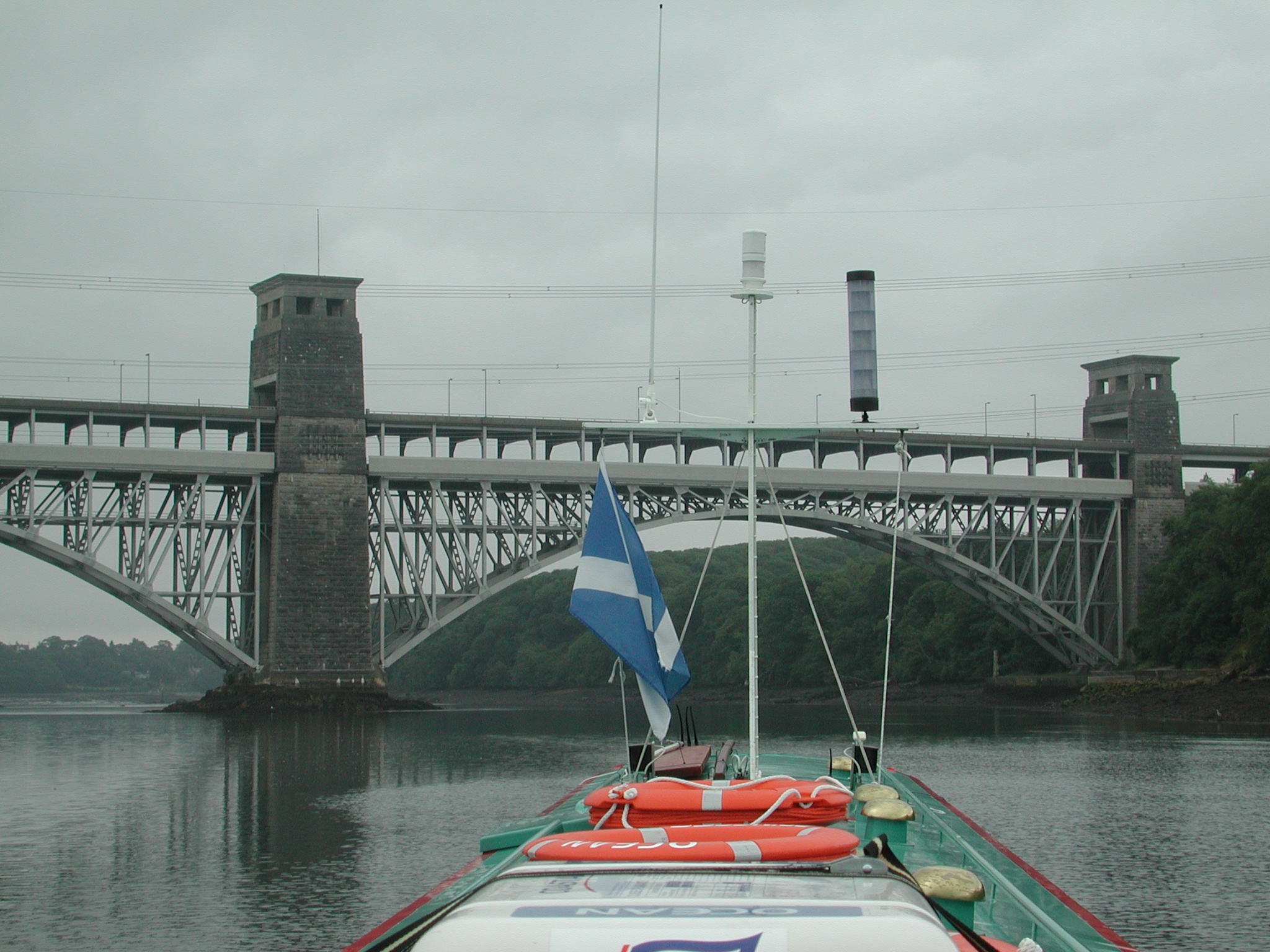
Britannia Bridge. Menai Straights.

Britannia Bridge. Menai Straights. The infamous Swellies start just beyond.

Just about to enter the Swellies. Menai Straights.

Britannia Bridge. Menai Straights.

The Swellies - at Low Water Neaps still quite swelly! Menai Straights.

The Swellies. Telfords Menai Straights Suspension Bridge comes into view.

Looking back at The Swellies and the Britannia Bridge. Menai Straights.

Coming out of the Swellies. Menai Straights.

Menai Straights Suspension Bridge.

Porthaethwy. Menai Straights.

Porthaethwy. Menai Straights.

Coming down the Menai Straights to Bangor Pier.

Bangor Pier. Menai Straights.

Bangor Pier. Menai Straights.

Porth Penrhyn. Menai Straights.

Beaumaris.

Looking back up the Menai Straights.

We take the main channel round Puffin Island.

The main channel round Puffin Island.

Trwyn Penmon Lighthouse.

Perch Rock marker and Puffin Island.

Great Ormes Head.

Llandudno.

Rhyl.

We creep out of The Welsh Channel to let this coaster pass.

Prestatyn.

We pass another coaster exiting from the port of Mostyn. Welsh Channel.

Point Of Ayr.
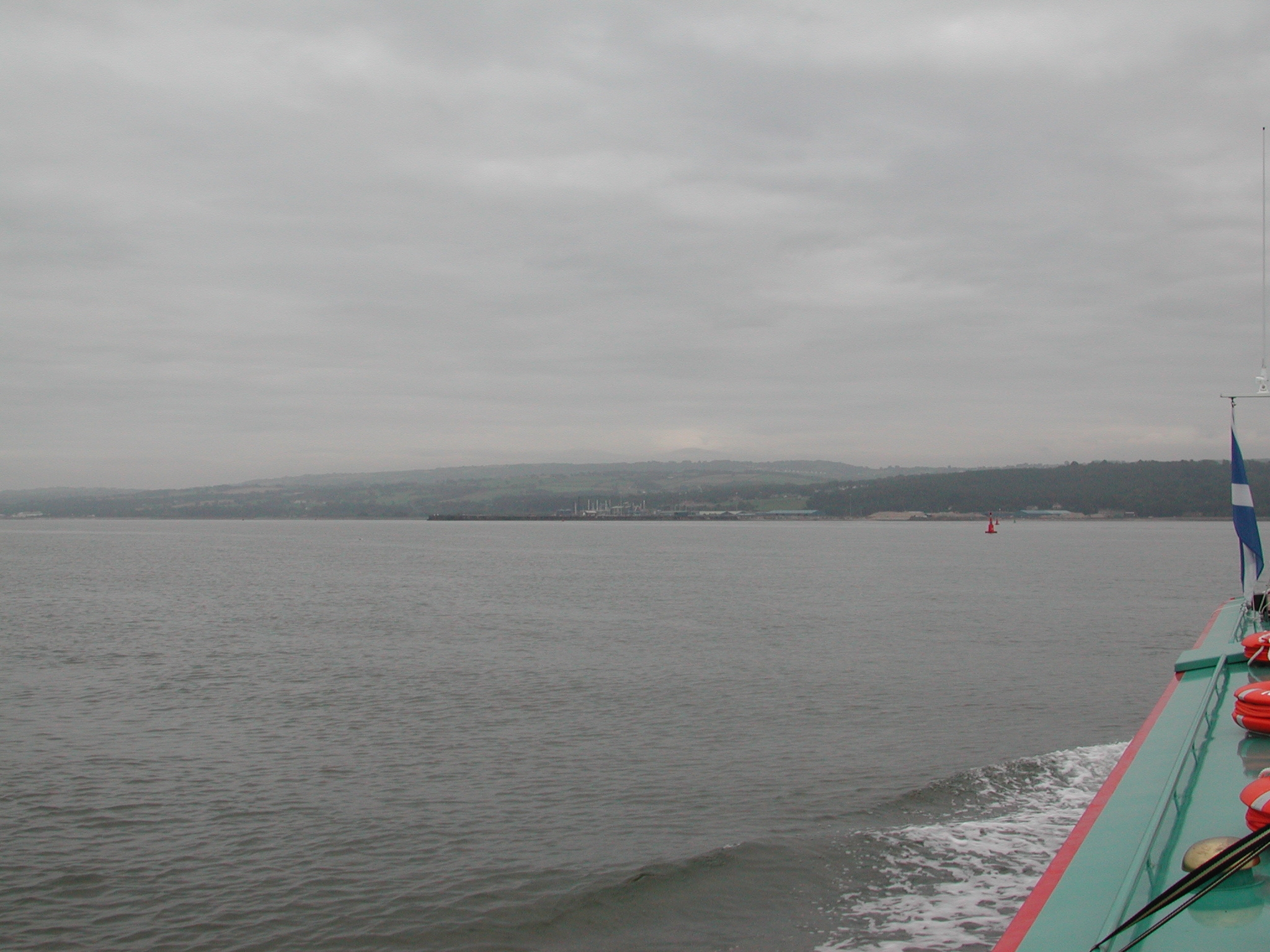
Approaches to the Port Of Mostyn. Dee Estuary.

Hilbre Island, Little Hilbre Island and West Kirby. Dee Estuary.

The BAe Airbus wing barge moored up at Mostyn. Dee Estuary.

The Port Of Mostyn. Dee Estuary.

Leaving Mostyn. There is no marked channel after this buoy, to the other side of
the beached "Duke Of Lancaster" ferry. Dee Estuary.

The beached "Duke Of Lancaster" ferry at Greenfield. Dee Estuary.

"Duke Of Lancaster". Dee Estuary.

It is only a centre channel buoy...but were we glad to reach it! Dee Estuary.

The channel takes a circuitous route to Flint. Dee Estuary.

Flint castle. Dee Estuary.
The training wall marking the end of the River Dee starts at this marker.
Connah's Quay in the distance. Dee Estuary.
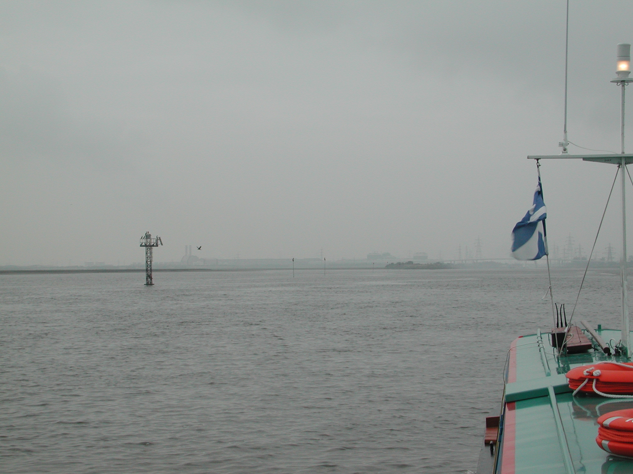
River Dee training wall marker. Dee Estuary.
Connah's Quay. Dee Estuary.

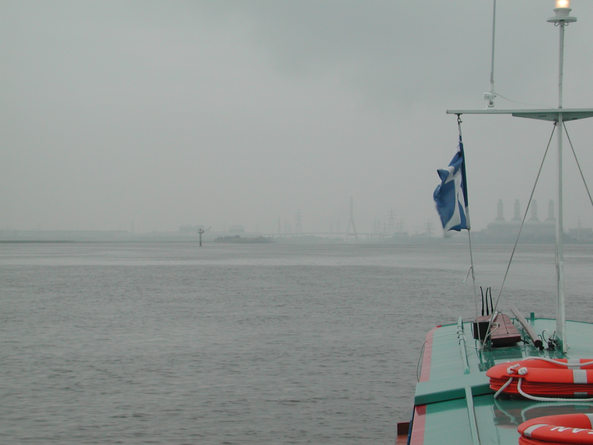
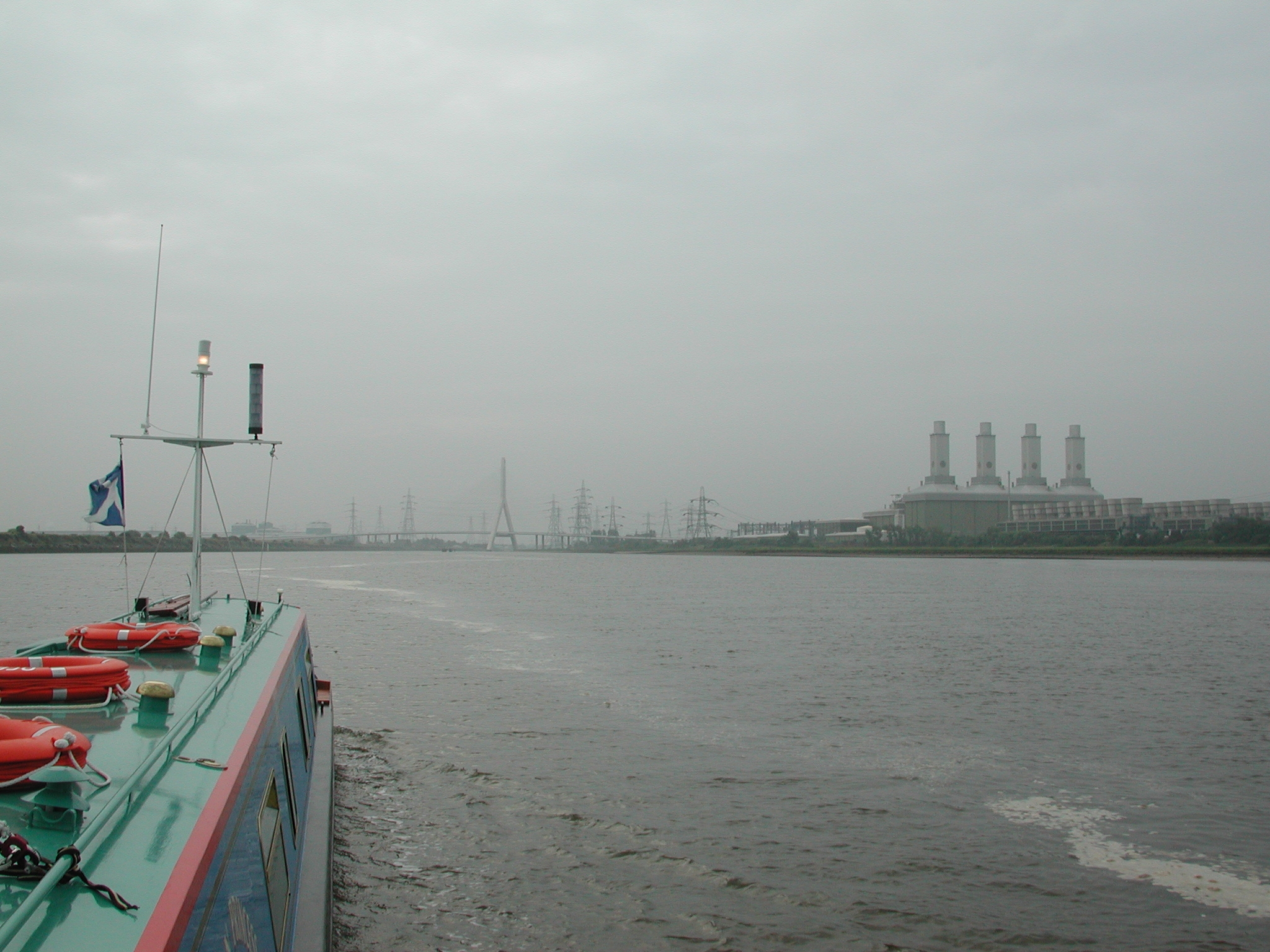
The new A458 Bridge. Tidal River Dee Outfall.

Looking back down the Dee Estuary and the training wall protection for the mud
flats / bridge pier.
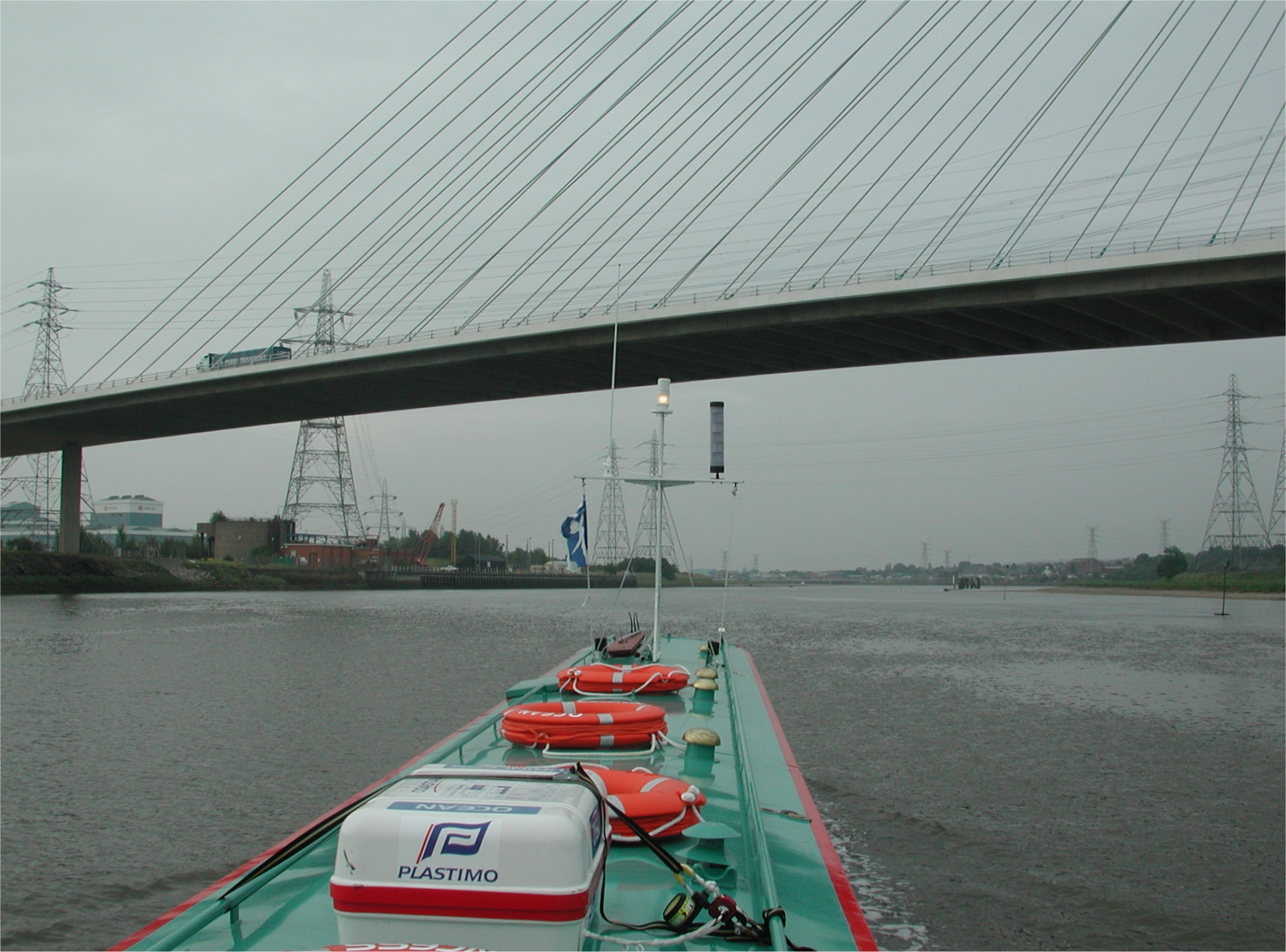
A458 Bridge. Tidal River Dee Outfall.

The wharf at Connah's Quay. Tidal River Dee Outfall.

Looking back at the A458 Bridge. Tidal River Dee Outfall.

The wharf at Connah's Quay. Tidal River Dee Outfall.

Looking back at the wharf at Connah's Quay. Tidal River Dee Outfall.

Hawarden Railway bridge. Tidal River Dee Outfall.

Hawarden Railway bridge. This no longer swings. Note the level board for the
wing barge traffic. Tidal River Dee Outfall.

Queensferry Bridges. Tidal River Dee Outfall.

Queensferry Double bascule bridge. Tidal River Dee Outfall.

Looking back at the Queensferry bridges. Tidal River Dee Outfall.

River Dee Outfall.

The BAe wing barge dock at Hawarden. Land and Water are dredging it out. Tidal
River Dee Outfall.

Higher Ferry Bridge. Tidal River Dee Outfall.

The final turn before Chester. Tidal River Dee Outfall.

The Dee Locks Branch of the Shropshire Union Canal exits just before the new
apartments. Tidal River Dee Outfall.

The Dee Locks Branch tidal lock. Tidal River Dee Outfall.

The Dee Locks Branch tidal lock.

The Dee Locks Branch. Shropshire Union Canal.

The Dee Locks Branch. Shropshire Union Canal.

The Dee Locks Branch. Shropshire Union Canal.

Does this gnarled old Muscovy Duck bare a resemblance to a certain narrowboat navigator?
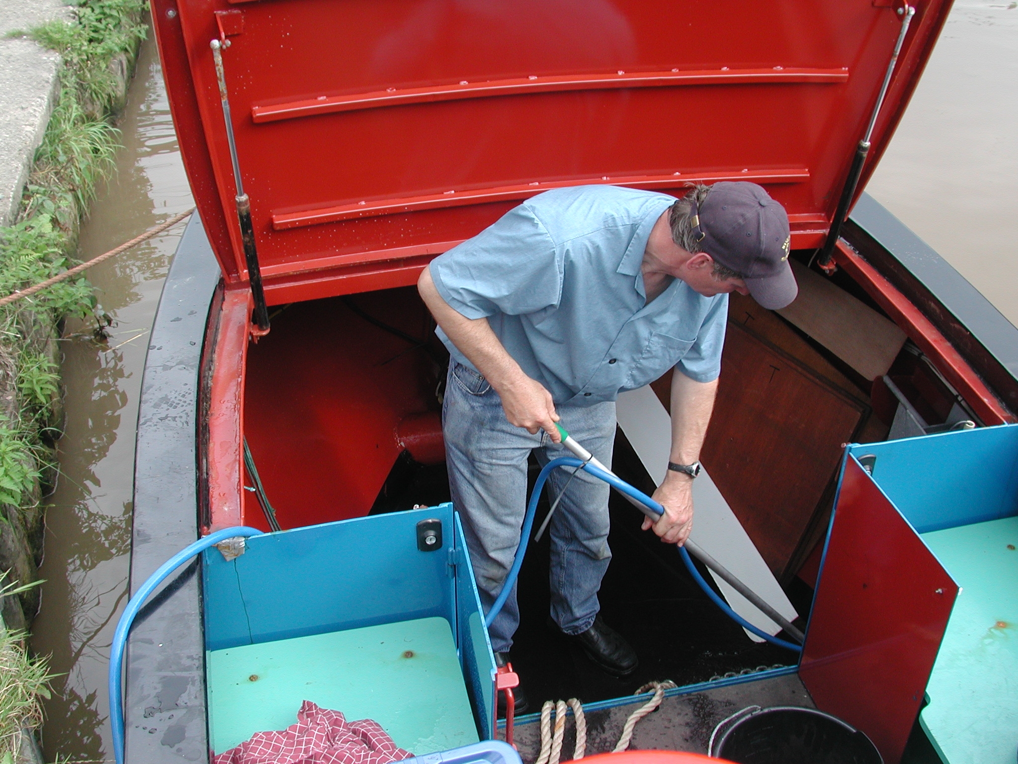
James takes advantage of the diesel stop at Chas Harden's to get rid of all the
salt!

Ocean Princess being put back into canal mode.
The Tour has ended - back to TNC Index Page.