
|
The Tuesday Night Club Official Web Site |
The Tuesday Night Club on Tour
The 1997 Mega Cruise
3. Torksey to Melbourne, inc River Derwent to Weldrake Ings Bridge, Tidal Trent, Tidal Ouse, River Derwent and Pocklington Canal.
3.30 on Saturday 28th June saw a
lot of bleary eyed crew members being coaxed out of their bunks
by Julian and Neil the normal early risers. We got off still in
the dark at 4.00 in blustery rain, Julian and Neil doing most of
the steering. The Trent was really quite up and when the ebb and
flow started to catch us we really started moving. We normally
calculate our speed on the B.W. bit of the Tidal Trent with their
handy Km marker posts and we throttled back to about 6½ miles an
hour so we would arrive at Trent Falls just before low tide at
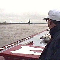
9.30. Ian Clarke our new Navigation and Communication Officer was
tried out just before Gainsborough, as due to the piling works
there, barge control had to be contacted. We were not expecting
much activity at around 4.45 in the morning, and we were right.
Ian C used our hand held V.H.F. for the first time, barge control
eventually replied saying that there was no activity. We got a
cheery wave from barge control, who were situated in a tied up
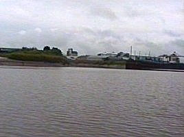
barge! West Stockwith was passed at 6.10 and the Trent began to
get a bit choppy. Keadby had been warned of our passage and we
had the option of going in there if the weather was too bad. By
the M180 Bridge the wind had died down and the rain had become
just drizzle. We decided to go for it and passed Keadby at 7.45.
There were two coasters moored up at Keadby, very close to the
lock entrance, if we had wanted to go in and had to wait for the
flood to get over the sill, it certainly would have been
interesting.
The tide was certainly well down
now and we hung out on the bends past Grove Wharf, Neap House
Wharf and Flixborough Wharf. Many coasters were closely passed as
we followed the Trent Boating Association Charts, and we got many
a cheery wave from crew members. From this point onwards the rain
stopped, much exposed mud could be seen and the channel was
spotted by the more turbulent water. We knew that depth was going
to be a problem and the 1 ft marked barge pole was used as a
gauge.
The tide we were on was getting on for Springs, so the
fall could be getting on for the 0.6 m minimum, when we started
to find the bottom at about 5ft we slowed down and used the pole
a lot. The shallowest point was at Burton Stather when the depth
in channel was only 3ft. By the Island Sand the depth had risen
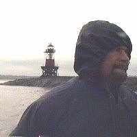
to about 5ft and when we cleared this Trent Falls light house
came into view. Trent Falls was reached at 8.50 and a discussion
broke out about whether we should carry on down the Humber until
we hit the flood, perhaps we might even get the Humber Bridge in
view. The captain decided that it would be more of a test of
"Beatty's" power to round Trent Falls and see if the
boat could get stuck into the last of the ebb and the large
amount of fresh that was probably coming down the Ouse.
When we rounded the light house
the Ouse stopped us like a wall, full power was used to gain
steering and pick our course as near to the inside of the bends
that soundings would allow. We throttled back slightly and made
steady but slow progress past Blacktoft Jetty. After this the
start of the flood began to slow down the fresh water coming down
the Ouse. On a bend just before Goole a graveler barge passed us
wrong side, hugging the outside of the bend, missing the bolder
covered bank by as little as 25ft. Goole was passed at 10.50.
Goole Railway Swing Bridge was passed (a Narrowboat can pass
under all the Ouse swing bridges at all states of most tides) and
we started to pick up a bit more speed from the flood. The last
serious commercial vessels were passed at Port Howden and we
began the tortuous route round Howden Dyke Island and the M62
Bridge. Julian was steering when we ran aground just upstream
from Lee Mouth. We were supposedly on course according to the
Trent Boating Association chart of the Ouse. Ian Clarke the
supposed Navigation Officer was taking a nap through all of this.
The channel where it changes from the South to the North bank
just before the M62 Bridge must have moved slightly up stream.
Neil took the helm and pulled the boat of in reverse the way it
went onto the mud bank and we were soon on our way again.
Boothferry Swing Bridge was soon passed along with Aire Mouth to
the south. Along this bend the famous "22 Poplars"
landmark could be seen, though we counted only 17. From this
point the huge Drax power station dominates the skyline.
We phoned up the Barmby Barrage
lock-keeper to warn him of our impending booked arrival. He would
not answer on V.H.F. and we had to resort to our trusty mobile
phones. The Locky said that the gates would be open and that he
had stopped sluicing. Neil made a gentle approach to the short
and narrow inlet and we were soon moored up in the safety of the
lock chamber. Locky appeared and the radial gates were soon doing
their business and we were out. The lock-keeper told us to moor
up on the floating pontoon a fair way upstream from the large
sluice gates and come back to his control room for our
"Pollution control" License.
Barmby Barrage was created
in 1975, before that date the River Derwent was tidal all the way
up to Sutton Lock. The object of the barrage was for flood
control, but I expect the real reason was to turn the Lower
Derwent into a large linear fresh water reservoir for the new
water works created just upstream. The old tidal River Derwent
had a right of navigation, so when the barrage was put in no
navigation charges could be levied. In 1975 the lock at Barmby
came under the control of Yorkshire Water. They decided to charge
for a yearly "Pollution Certificate" for powered craft
on, or entering the Derwent to stop dirty boats polluting their
new linear reservoir.
This "Pollution Certificate" is a license in all but name only, to help pay for the use of the new
lock. Upon receipt of £12 the very bored lock keeper and sluice
controller gave us the license that he had already filled out. We
had to fill out a very basic form, basically saying that if we
had a sea toilet we would not discharge it in the river. The
sluice gates seemed to be completely computer controlled, the
lock keeper showed us the flow rates and how they were
particularly confused for this time of the year, but failed to
mention what effect it would have on navigation.
Soon "Beatty" was
whizzing up the Derwent having left Barmby at 13.20, but above
the waterworks the flow began to increase and we began to get
"stuck in". One reason for planning the cruise with a
fairly early arrival is that there is officially no overnight
mooring at Barmby. The next place is "The Breighton
Ferry" pub at Breighton, but this needs a prior booking. Our
plan was to get off the Derwent and onto the Pocklington Canal
where we knew we would be able to moor. "The Breighton
Arms" was soon reached, but there were no moorings available
at all, they were all taken by permanent berths. Above Derwent
Bridge the river flow decreased slightly, that was because the
bridge had pounded up the water and the river was right over its
water meadows and right up to the flood banks.
Depth soundings
were taken slightly offline of the course, which could be traced
by bush tops and lines of stinging nettles. There was only about
2½ feet so it was imperative to keep in channel, or we might
have ended up beached in a farmer's field, looking even more
silly than Neil's idol this year (Chris Coburn, N.B. Progress).
With much depth sounding using our trusty barge pole we kept in
channel, only having to reverse off once.
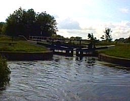
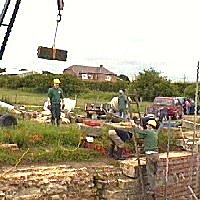
East Cottingwith Lock was reached
at 16.30 and we decided to push onto Melbourne Arm Basin. East
Cottingwith Lock is meant to have a fall of 6ft 6ins, but we
sailed through it with top and bottom gates open and the water
running into the canal. The river was obviously over 6ft
6ins up, we tried to shut the top gates to no avail, so we held
them nearly shut with a piece of old rope. When in planning stage
we had been warned by B.W. Naburn that Swing Bridges 1&2 were
being replaced, but the period we would be on the canal should
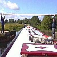
see them removed.
When we arrived planks had been left across the
bridge hole so two crew members were dispatched to turn them into
lift bridges! Above Gardham Lock the canal, though deep became
more weedy and we had the weed hatch up a few times. We arrived
in Melbourne Basin at 18.35, 14½ hours non stop from Torksey and
at 79 miles the greatest distance we have ever covered in a day.
We had a stroll about the village and ended back at the excellent
"Cross Keys" pub for solid and liquid refreshments.
Sunday 29th June saw us have a lie
in and one of Julian's "Heart attack on a plate" mega
breakfasts. To recover from this we decided to walk to Canal Head
and not even attempt to take the boat any further. On our walk we
assessed the canal and thought we could have got to the Bielby
Arm to wind. The new Nicholson Guide says the canal is navigable
beyond Bielby to the bottom of the next lock, Coates. The canal
was heavily weeded, but it seemed deep enough. We could not move
Swing Bridge No 8, perhaps the farmer had jammed it shut. When we
got to Coates Lock some friendly Pocklington Canal Amenity
Society members were just unloading their cars to continue the
restoration of this lock. They thought we had come to help, when
we said were from London on our boat they said we must be from
THE boat on the canal, moored in Melbourne.
We asked them about
the newly restored swing bridge just below and was it stuck. They
said it certainly was, it has no bearing or pintel as they were
saving up for this expensive item. Last year they raised the
bridge on jacks and a flotilla of boats reached Bielby. We said
that we were walking to Canal Head and they recommended the
"Wellington Arms" for a drink and would we like a brass
plaque? Neil said we certainly would. The members are not ones
for rally plaques etc. but we like to collect those that plot our
aim of cruising all possible waterways in England and Wales.
Ian
Clarke bought one for "Beatty" and afterwards wished he
had bought another for "Straight Across". There are
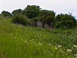
three un-restored locks above Coates Lock, the chambers are in good
condition only gates and paddle gear being needed. The canal was
in water, stop planks holding it back, we were told this was a
rare occurrence, due to all the rain. The terminus basin is in
water the new top gates of the restored Top Lock holding it in,
bottom gates were still needed. The P.C.A.S. members we met said
they often have a small sales stand at Canal Head and that it
would be open today. As we walked up to the Pub a grey Granada
pulled up, could they be setting up their stand just for THE
boaters on their canal?
We crossed the busy road to the
pub, and as we drew up to the door it opened, we had arrived two
minutes early. It was a nice day so we sat outside. Suddenly
there was a thump and a shower of feathers as a dopey pheasant
was hit by a speeding car. It landed in the centre of the road
and Ian Scott braved the speeding traffic to rescue it. Ian laid
it at the side of the road still twitching. We said to Ian it
would be better to finish it off. Ian went to the injured bird,
but at that moment it began to come round, so he left it to see
if it was ok.
Within 5 minutes it was hopping across the road on
one leg, when it saw an approaching car both legs started working
and it zoomed of into the hedgerow, perhaps it had learned its
lesson. We eventually left the pub and went back to the basin.
The P.C.A.S. members had set their wares out in front of their
hut and we had a chat and bought some maps, guides and history
books. Over lunch we decided to carry on up the River Derwent as
far as we could, which according to the new Nicholson Guide, due
to legal reasons, was the first and only restored lock at Sutton
Bridge.
On the way back we stopped of at Coates Lock, which was
now a hive of activity. We met the very friendly and
knowledgeable lady Secretary of the society Sheila Nix and had an interesting discussion with her. She
asked us where we had come from and when we told her she remarked
that she wished a few more local boaters would come on to their
canal which was beginning to get weeded up again through lack of
use. We asked her about the rest of the restoration and
she said that discussions with B.W. and English Nature were at a
critical stage. The society hoped the out come would be that they
could dredge and finish the restoration, probably trading this
off with a limit on boat movements as vitally the whole canal was
designated a Site Of Special Scientific Interest (SSSI).
The crew
replied that like on the Basingstoke Canal this quota would never
be exceeded as the water supply looked limited. Sheila said
that this was so and that we were very lucky for this time of the
year to see the whole canal full of water. We also asked her
about the legal status of Sutton Lock and the Derwent above to
Stamford Bridge. She remarked that she had been heavily involved
with the now moribund River Derwent Trust. She told us that Nicholson's was speaking rubbish, it has not been proven who
"owns" Sutton Lock mitre gates, the E.A. probably did
as they own the weir and guillotine gate, but they did not want
to be drawn into the right of navigation argument.
It was
perfectly possible to cruise to Stamford Bridge, Sutton Lock was
not locked up, but if we tried it DO NOT moor on any riparian
owners banks above Sutton Lock, the only place to moor being in
Stamford Bridge Lock chamber. The crew wished her well with their
restoration effort and we legged it back to Melbourne with
renewed vigor.
We made a hasty retreat from
Melbourne, hoping that as there had not been any more rain, the
swollen River Derwent had receded. As we approached East
Cottingwith Lock things did not look good, water from the canal
was flowing over its banks into the Ings marshes. The lock was
another motor straight through affair, Neil looked at the level
indicator, it had gone up another two inches! We rounded the
corner into the River Derwent and hit the flow of the river. It
seemed forceful and obviously alien to this river, which we
imagine must normally have no flow on it at all.
"Beatty" seemed to have plenty of power in reserve so
off we went, we would attempt to get to Stamford Bridge tonight
even if it meant a little dusk cruising.
As we approached Broken
Bridge, the cobbled together remains of North Hill's Drawbridge disaster loomed, the skeletal remains of the bridge
appeared to have a navigable height of one foot! The run up to
the centre span had no cross beams and there seemed about a seven
foot gap between two rotten upright timber baulks which were
toped with some nasty "cruiser sinking" bolts. Neil
exclaimed "We are going through there!", but there was
one small detail to attend to, the flood had washed down a large
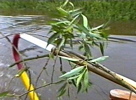
Willow bough, which was pinned across the gap.
"Beatty" was nosed gently up to the centre steel cross
beams of the bridge and moored to it.
Ian Clarke and Neil plus saw
and barge pole clambered over the rotten remains of the
bridge to confront the branch. After about half an hours struggle
most of the branch was sawn away, the remains being tied back
with an old piece of rope. The depth was checked in our new
channel, it seemed about five feet with no other protuberances.
With every one now on board "Beatty" was untied and
drifted back to the start line. With Captain Arlidge at the helm
the boat was eased through the gap with out any problem, when we
came back we would have to go some to get control over the flood.
After visually marking the return approach to Broken Bridge we
trundled on. We passed a lot of Willow trees crowding the narrow
channel, we were obviously meant to be navigating UNDER these
branches. Soon the next Bailey Bridge was encountered, it looked
low. "Beatty" trickled up to it, even if we had removed
the cratch, we were missing about 2 inches of air draught. That
was obviously going to be our head of navigation on this passage
of the River Derwent. T.N.C. On Tour have always been extremely
lucky on their cruises, we have always achieved our goals and
more, now we finally knew failure.
Now for the return, Neil knew
this was going to be the skilful bit, first turning a 50 ft
Narrowboat in a 75ft fast flowing channel with a lot of trees,
second going fast to get steerage with the flow and lastly
getting round Broken Bridge while going fast, with no room for
error. The turning was the worse bit, after two attempts we
realised that "Beatty" was powerful enough to get
parallel to the flow, but we had to get the stern in still water
so the flood could bring the bow round. We succeeded on the third
attempt. but the bow was dangerously near the ever present Willow
trees. The two Ian's scattered as "Beatty's" super
strong cratch demolished a few Willow branches, we were off!
What
followed was the fastest Narrowboat ascent of this part of the
Derwent. In no time at all we came across Broken Bridge, Neil
kept most of the power on, aimed the bow at the gap and at the
last moment gave that kind of flick of the rudder you can only do
in a cruiser sterned Narrowboat. We missed the bush that obscured
our new channel downstream, the stern shot round and we whistled
through the gap with a gentle lurch. In the whirl pool behind us
a few bits of rotten timber circled, we had made it unscathed!
Ian Scott and John Rushbrook were meant to be back Sunday night, but had realised that they would have to stay overnight. This would have to be from where ever we got and travel back Monday morning, by taxi to York, train to Retford then Passat to London. We decided the only place to moor was in East Cottingwith Lock, there was no one up stream of us and no one was likely to come up in the dark. We turned "Beatty" just before the lock, we wondered if this is usually possible? Ian went of to the local pub to book a taxi for tomorrow, as we loosely moored "Beatty" in the chamber. Head Chef Julian cooked one of his excellent meals and we decided to stay on board to drink the beer lockers dry as we commiserated our first failure.
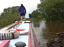
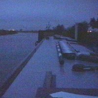 4am start at Torksey. (Very) High Water, we will be going down to Trent Falls on the Ebb |
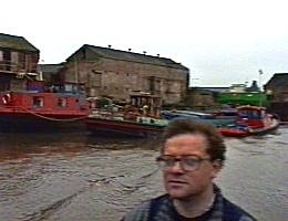
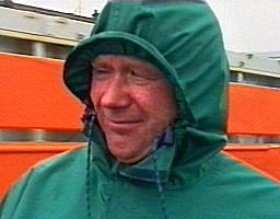
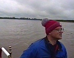
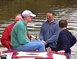
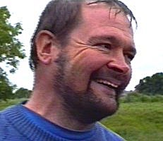
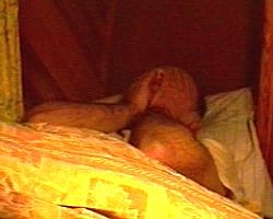 Colin moans "What bloody time do you call this?" |
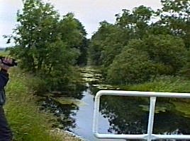
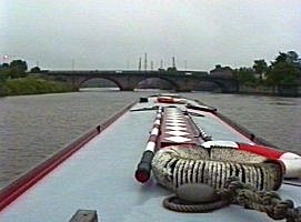 Gainsborough Arches, our radio communications officer tries out the VHF. Tidal River Trent to Trent Falls. |
 Gainsborough. There does not seem to be much piling work at 6.00am! |
 J.R. at the helm passing barge control who we must have woken up! |
 We steam passed West Stockwith, entrance to the Chesterfield Canal. Tidal River Trent to Trent Falls. |
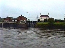
 Soon the entrance sluice to the River Idle is passed. |
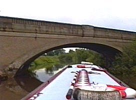
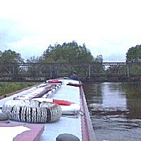
 Keadby road / rail bridge. |
 Keadby Lock is here somewhere, we have decided to go for it as the storm has subsided. Tidal River Trent to Trent Falls. |
 Grove Wharf. Tidal River Trent to Trent Falls. |
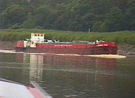
 Julian following the Trent Boating association Charts to the letter creeps right up to the orange coaster. |
 Flixborough Wharf. Tidal River Trent to Trent Falls. |
 At Burton Stather the rain starts again and as it is a Spring tide we start to run out of water |
 Trent Boating Association charts. We end up following the channel which shows up as the rougher water, at one point it goes down to 5ft! |
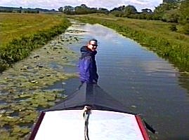
 Trent Falls, Ian Clark looks onward towards The River Ancholme and the Humber Bridge! |
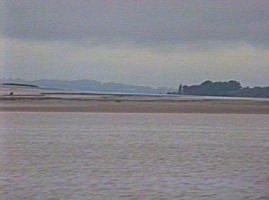 Looking on down the Humber from Trent Falls. |
 We have now turned up the tidal River Ouse and are gallantly battling against the last of the ebb. |
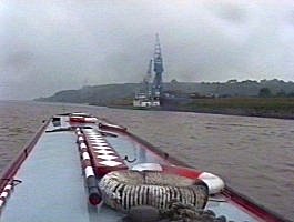
 Blacktoft Jetty, that we seemed to be passing for ages. Tidal River Ouse. |
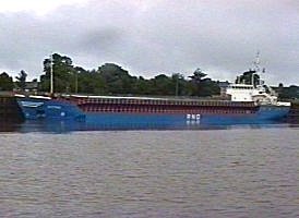
 The only commercial craft we met, a barge hogging the deep water. |
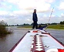
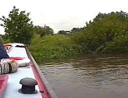
 J.R. in control. Tidal River Ouse. |
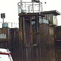
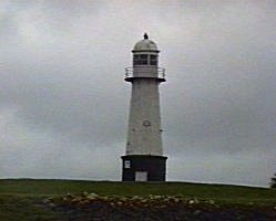 Ouse light house before Goole. Tidal River Ouse. |
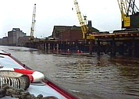
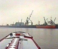
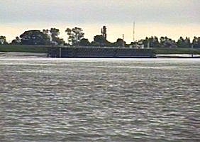
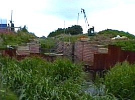
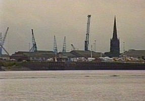 The first telephoto shot of Goole docks. |
 Entrance to Dutch River to the left of the breakwater, Ocean Lock to the right. |
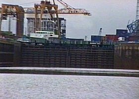 Ocean Lock, Goole Docks. Tidal River Ouse. |
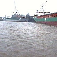
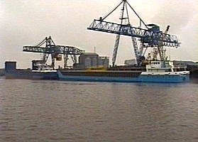
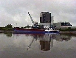
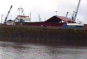 Coaster in Goole Docks. |
 Large coaster berthed at Goole. |
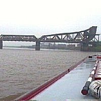
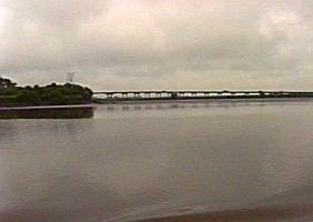
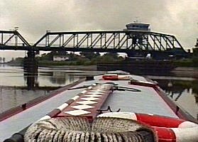
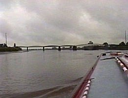 Goole Railway Bridge. Tidal River Ouse. |
 Goole Railway Bridge. |
 Ian Clarke keeping watch over the charts. |
 Howden Dyke Wharf. Tidal River Ouse. |
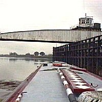
 M62 bridge hidden by Howden Dyke Island. |
 M62 Bridge. We have skirted more to the left than shown on the charts as we ran aground! We will pull over to the right to take the right hand span. Boothferry Bridge in the distance. |
 Boothferry Bridge. Tidal River Ouse. |
 Looking back up River Aire and start of 22 Poplars. Tidal River Ouse. |
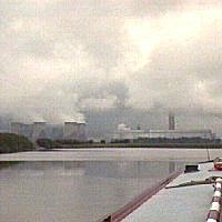 Drax Power Station, is this really a hudge cloud making machine? Tidal River Ouse. |
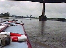
 Entering Barmby Lock, sluice to right. Tidal River Ouse. |
 The outer radial gates slam shut and we think that is the end of our troubles! |
 Up on Barmby Sluice control cabin. |
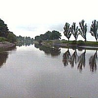
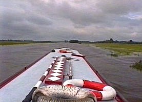
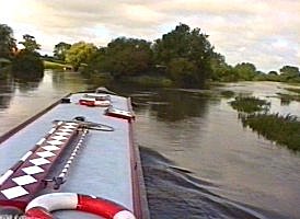
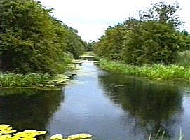
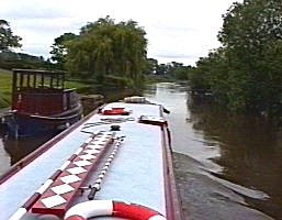
 We all settle down on the tranquil River Derwent. |
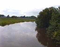 The River Derwent below Loftsome Bridge. |
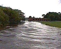
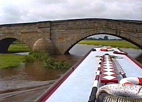
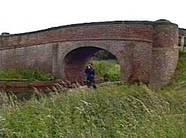
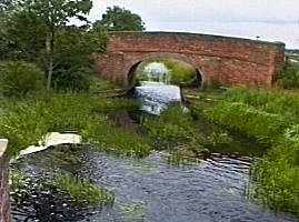
 Loftsome Bridge. River Derwent. |
 The "Breighton Ferry" pub, there were no visitor moorings all being taken up by permanent berths. |
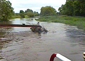
 Approaching Bubwith dismantled railway bridge. It is here that the flow increased and we realised the river was not as it should be! |
 Derwent Bridge, Bubwith |
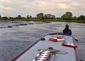
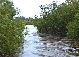
 River Derwent in flood, trying to find course! |
 The flooded water meadows above Derwent Bridge. |
 The flooded water meadows above Derwent Bridge. |
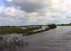 The flooded water meadows above Derwent Bridge. |
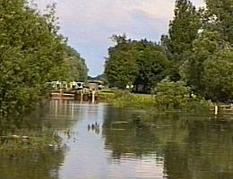
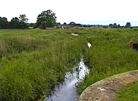
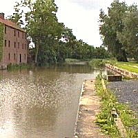
 Junction of River Derwent (left) and Pocklington Canal. |
 The flooded approach to Cottingwith Lock. Pocklington Canal. |
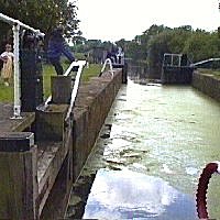 Cottingwith Lock, straight through! |
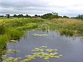
 The over full canal through Storwood Ings |
 Lift Bridge Number One. The bridge was away for repairs. |
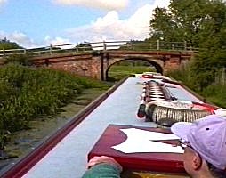 Hagg Bridge. Pocklington Canal. |
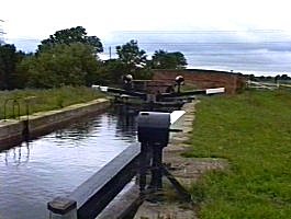
 Leaving Gardham Lock |
 Swing Bridge No4. Pocklington Canal. |
 Bridge No5. Pocklington Canal. |
 Swing Bridge No6. The rails fold down to let wide farm equipment pass over. Pocklington Canal. |
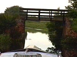
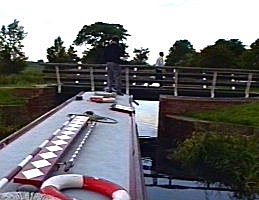 Swing Bridge No7, entrance to Melbourne basin is to the right just beyond this. |
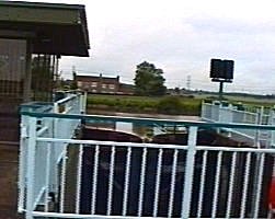
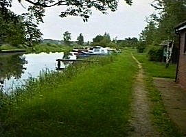 Melbourne Basin. Large sanitary Station and volunteers stores to the right. "Beatty" and these two moored up cruisers were the total craft on the Pocklington Canal! |
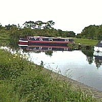 "Beatty" at rest in Melbourne Basin. |
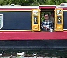 J.R. feeding the ducks |
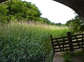
 The start of our walk up to Canal Head. Church Bridge, Pocklington Canal. |
 Thornton Lock |
 Thornton Lock, looking back to Church Bridge. This is meant to be navigable! |
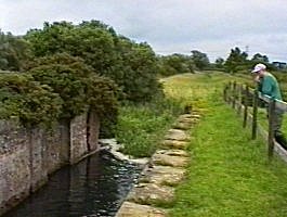
 Looking down from Walbut Lock at Walbut Bridge. Pocklington Canal, restored but not dredged section. |
 Walbut Lock. |
 Just above Walbut Lock. Pocklington Canal, restored but not dredged section. |
 Looking up from Swing Bridge No8 (Not yet swinging as it has no bearing!) |
 Looking up the Bielby Arm. Pocklington Canal, restored but not dredged section. |
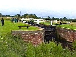
 Coat's Lock, site of the P.C.A.S. next restoration project. |
 Looking down from Coat's Bridge. Pocklington Canal, restored but not dredged section. |
 Pocklington restoration under way at Coat's Lock |
 Coat's Lock |
 Sandhill Lock. Pocklington Canal, un-restored section. |
 Colin muses over Sandhill Lock. Pocklington Canal, un-restored section. |
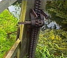 Remains of old ground paddle. Sandhill Lock. Pocklington Canal, un-restored section. |
 Giles Lock. Pocklington Canal, un-restored section. |
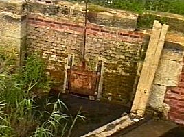
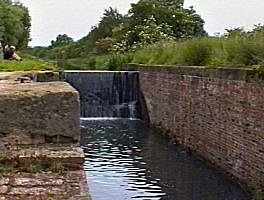
 Top Lock into the basin. This chamber has been restored and top gates fitted so that the basin can be filled. |
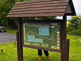 The Pocklington Canal Amenity Society (P.C.A.S.) display board at Canal Head. |
 Canal Head Basin. |
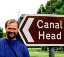 Canal head at Canal Head. |
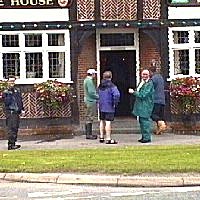 "Wellington Oak" at Canal Head, two minutes early! |
 Continuation of our River Derwent cruise. "The Ferry Boat" pub moorings taken by permanent resident! |
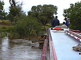 We arrive at Broken bridge (Formally the North Hill Drawbridge). This should have at least 6ft air draught, it has 1ft! |
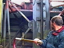
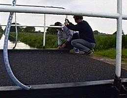
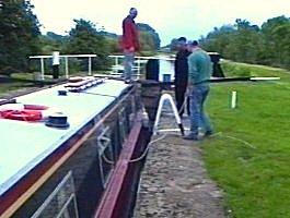
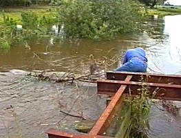 Although the level is up at least 6ft "Beatty" has no problem with the flow, so we decide to go round Broken Bridge. The boat hook was used to check for other timbers to the left side. The main problem was this washed away branch. Here Neil is sawing it up! |
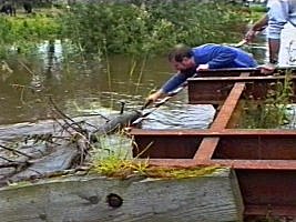 Neil assisted by Ian Clarke pull the remains out of the way and tie it up to the bridge. |
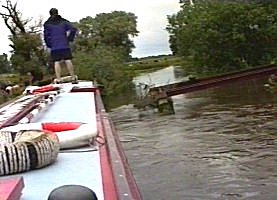 We pull back and line up for the attempt. |
 The stick near the side of "Beatty" is in fact a long bolt sticking out of another vertical timber. |
 We made it having flipped out of the tree visible up stream on the previous tree cutting images. It was going to need a very fast and skilled steering return passage! |
 We navigate through the tops of trees! |
 Neil gains a trophy! |
 Which he seems to find amusing! |
 The end of the River Derwent for us, the bailey bridge above Broken Bridge. The site of Wheldrake Ings Bridge is just above this, apparently at normal water levels some of the old timbers are visible. |
 "Beatty" proves an old bitch to get round with all the flow on and we nearly have another tree trophy! |
 Our mooring for the night, we reverse back into Cottingwith Lock. |
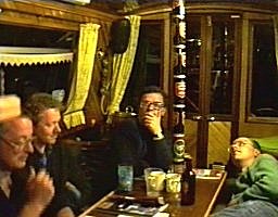 Ian Clarke, Ian Scott, John Rushbrook and Colin. Drowning our sorrows. |
||
Home Page | "Earnest" | "Beatty" | Canal Restoration