|
The Tuesday Night Club Official Web Site |
The Tuesday Night Club on Tour
Irish Summer Tour 2007
31 - Enniskillen to Naan Island, inc Lower Lough Erne to Carrickreagh, Upper Lough Erne.
Saturday 21st July 2007
Seeing as we had time on our hands we decided to go back into the southern section of Lower Lough Erne and investigate a couple of the backwaters and jetty moorings we had missed. After an uncharacteristic late TNC start of 11:50, we set off back to Lower Lough Erne. At 13:05 we rounded Lodge Point on Ely Island, not really an island,
a
promontory, half way along the west shore of the south section of Lower Lough Erne. To our right was now Inish Fovar then Inish Lougher as we followed the shore line into Carrickreagh Bay. Moored on the tiny jetty was a small cruiser, but soon after we arrived
at 13:30 it departed. It was a lovely sunny day (unlike most we had!), so we chilled out further and had an hours lunch break.
We carried on round Carrickreagh Point, then between Gall and Pushpen Islands. Rounding Pushpen Island we went for a twirl round
Cammagh Bay, passing the
Camagh Bay jetty and Blaney Bay (14:50). From here we went back out into the main channel in Lower Lough Erne and headed back to Enniskillen, which we passed at 16:25. Continuing back up the River Erne, we took the easterly route round Cleenish, Knock and Inishmore Islands. This route took us past the busy moorings at Carrybridge. After entering the top of Upper Lough Erne we tied up on Naan Island West jetty (our favourite on Upper Lough Erne) at 19:40. We shared the jetty with only one other boat, a steel cruiser "Milanique". After a spag bol and red wine meal we had a short wander round the island, which was somewhat
water logged. We spent the rest of the evening on the back deck watching and photographing the fine sunset.

We head down Lower Lough Erne again to check out Carrickreagh. We will turn
round the promontory to the left and behind Inish Fovar. Lower Lough Erne.

Inish Fovar to the right. Lower Lough Erne.

Looking back at the house and private mooring on the inside of Ely
"Island". Lower Lough Erne.

Looking back at the entrance bridge into Castlehume Lough (not navigable, on the
inside of Ely "Island"). Lower Lough Erne.

To the left, the west shore of Lower Lough Erne, to the right, Inish Lougher.

Carrickreagh Jetty. Lower Lough Erne.

Carrickreagh Jetty. Lower Lough Erne.

Carrickreagh Jetty. Lower Lough Erne.

Carrickreagh Jetty. Lower Lough Erne.

Looking back at Carrickreagh Jetty. Lower Lough Erne.

Heading up out of Carrickreagh Bay, Gall Island to the right (east) and Pushpen
Island, dead ahead. Lower Lough Erne.

Passing Carrickreagh Point and Pushpen Island (not navigable between). Lower Lough Erne.

Heading into Cammagh Bay. Lower Lough Erne.

Blaney Bay. (bay below Cammagh Bay). Lower Lough Erne.

Looking back at the un-navigable channel between Pushpen Island and Carrickreagh
Point. Lower Lough Erne.

Cammagh Bay Jetty. (Popular with water skiers). Lower Lough Erne.

Exiting Cammagh Bay. Lower Lough Erne.

We are now up the River Erne, past Enniskillen.

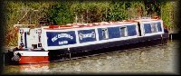
Northern Ireland Police Force boat. River Erne.

Waterways Ireland Warden. Go on book 'em Danno! River Erne.

The east and west routes round Cleenish, we take the east. River Erne.

The east route round Cleenish. River Erne.

The east route round Cleenish. River Erne.

The east route round Cleenish. River Erne.

The east route round Inishmore. River Erne.

The east route round Inishmore. Carrybridge. River Erne.

Carrybridge. River Erne.

Looking back at Carrybridge. River Erne.

The east route round Inishmore. River Erne.

The east route round Inishmore. River Erne.

Entering Upper Lough Erne.

Upper Lough Erne.

Naan Island West jetty. Upper Lough Erne.

Naan Island West jetty. Upper Lough Erne.

Sunset from Naan Island West jetty. Upper Lough Erne.

Sunset from Naan Island West jetty. Upper Lough Erne.
Home Page | "Earnest" | "Beatty" | Canal Restoration