|
The Tuesday Night Club Official Web Site |
The Tuesday Night Club on Tour
Irish Summer Tour 2007
27 - Grange to Boyle Harbour - Grange Lough, Shannon Navigation, (inc up to Drumsna), Boyle River and Lough Key.
Tuesday 17th July 2007
It was a 08:10 departure from Grange, a drab and dreary start to
the day. We exited Carnadoe and back up the Shannon at 09:25. Below Albert Lock,
we carried on up the Shannon, which is navigable for around half a mile up to
Drumsna Bridge. Here there are some quay moorings for the village. We spent
10:20 - 11:10 here for a water and provisioning stop. It was then back down to
Albert Lock, and the Jamestown Canal Shannon Navigation Channel, which bypasses
this loop of the river.
After Albert Lock (11:30 - 11:50) we passed out of Jamestown Cut and headed down
stream, the short distance to Jamestown Quay, just above Jamestown Bridge, the
top end of this un-navigable loop of the Shannon. We had a wander around after
mooring up on the empty quay (12:15 - 12:20). Again we headed back up the
Shannon, passing Carrick Bridge at 14:00 and passing off the Shannon, onto the
River Boyle at 14:25.
After a narrow start to this navigation it opens out into Lough Eidin /
Drumharlow and we took the left hand (west) way round Inishatirra island. The
Boyle River enters from the west corner, so we took this markered course. A golf
course skirts this river section to the west, after this Cootehall appears, with
visitor moorings just before the bridge, on the east side. Just before
Cootehall, there was a large new marina development to the west and some new
housing just after the bridge, somewhat close to the river! After Cootehall the
navigation passed through Oakport Lough, then it begins the river section that
takes it into Lough Key.
On this section the large Shannon-Erne Waterways Holidays Marina is passed to
the east (right), then Knockvicar Bridge. Not long after this the weir appears,
flanked by Clarendon Lock to the east (right). The level was up and the bottom
lock landing was under water. We hovered about until a boat was locked down.
Clarendon Lock took between 15:40 and 15:55. After the lock the river opens out
into Lough Key, the old Tara Cruisers base, (now a private marina and
restaurant) is to the east (right).
We took the main buoyed channel through the lake, between Bullock and Sally
Islands, then south between Drummans and Orchard Islands into Rockingham Bay.
Here the Lough Key Forest Park has been created in the grounds of the old
Rockingham Estate. We first went past the visitor moorings on Drummans Island
then close by the moorings by the suspended walkway and the moorings in the bay.
On the way out of the bay we passed close by Castle Island, which has the fairy
tale ruins of an idealised castle.
Once passed Drummans Island we turned to west and headed for where the River
Boyle enters the lake. This soon became a narrow river course. A half mile up
the River Boyle the recently constructed Boyle Canal enters from the north and
we entered this at 16:50, come 17:00 we entered the new, but rather small Boyle
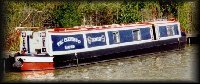
Harbour. There were no outer moorings left, so we had to take one of the cruiser
length berths, from which Earnest rather protruded! That night we took the fairly long hike into town and went to the
Royal Hotel for a pint and a meal.

Leaving Grange. Grange Lough.

Leaving Grange. Grange Lough.

Coming back down Grange Lough.

Below Albert Lock we carry on up the Shannon to Drumsna. Shannon Navigation.

Shannon Navigation up to Drumsna.

Drumsna, as far as you can get up the bottom of the loop of the Shannon bypassed
by the Jamestown Canal.

Drumsna. Shannon Navigation.

Drumsna.

Drumsna.

Drumsna Bridge.

Leaving Drumsna. Shannon Navigation.

Back at the approach to Albert Lock and the Jamestown Canal.

Visitor moorings above the upper bridge on the Jamestown Canal. Shannon
Navigation.

Looking down the Shannon from where the top of Jamestown Canal exits. This is
navigable down to the wharf above the bridge in Jamestown. Shannon Navigation.

The wharf in Jamestown. Shannon Navigation.

The wharf in Jamestown. Shannon Navigation.

The wharf in Jamestown. Shannon Navigation.

The wharf in Jamestown and Jamestown Bridge. Shannon Navigation.

Pi$$ing rain! Shannon Navigation.

We have just left the Shannon and are going up the River Boyle.

We take the left hand (west) way round Inchatirra. Lough Eldin, Boyle River.

Golf course to the left (west) Boyle River.

Boyle River.

Just below Cootehall. Boyle River.

Cootehall. Boyle River.

Cootehall Wharf and Bridge. Boyle River.

Cootehall Bridge. Boyle River.

Above Cootehall Bridge this new housing seems to be built out into the river
course! Boyle River.

Looking back at Cootehall from Oakport Lough. Boyle River.

Knockvicar. Boyle River.

Knockvicar Bridge. Boyle River.

Clarendon Lock at Knockvicar. Boyle River.

Clarendon Lock. Boyle River.

Clarendon Lock. Boyle River.

Clarendon Lock. Boyle River.

Clarendon Lock. Boyle River.

Clarendon Lock. Boyle River.

Clarendon Lock. Boyle River.

Clarendon Lock. Boyle River.

Clarendon Lock. Boyle River.

Looking back at (Formally Tara Cruisers) Marina. Boyle River.

Looking back at Boyle River from Lough Key.

Looking across at Sally and Orchard Islands and the Lough Key Forest Park
(formally Rockingham). Lough Key.

The channel to the Country Park goes round Sally and Orchard Islands. Lough Key.

Looking up to the north of Lough Key.

The Country Park moorings are ahead. Lough Key.

Drummans Island Moorings. Lough Key.

Lough Key Country Park moorings.

Castle Island. Lough Key.

Lough Key Country Park moorings.

Lough Key Country Park moorings.

Castle Island. Lough Key.

Heading to the west end of Lough Key.

Heading to the west end of Lough Key. Boyle River comes in dead ahead.

Entering Boyle River, up to Boyle.

Looking back down Lough Boyle from Boyle River.

Looking back down Lough Boyle from Boyle River.

The new canal to the harbour at Boyle, exits the Boyle River at this
point.

Boyle Harbour Canal.

N4 Road Bridge. Boyle Harbour Canal.

Boyle Harbour....not the most wonderful design!

Boyle Harbour.
Home Page | "Earnest" | "Beatty" | Canal Restoration