|
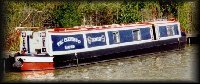
The Tuesday Night Club Official Web Site |
The Tuesday Night Club on Tour
Irish Summer Tour 2007
21 - Ballina to Dromineer - Shannon Navigation and Lough Derg, inc Scarriff River.
Wednesday 11th July 2007
Today was the start of the serious, look around the ports, harbours and rivers off Lough Derg. We started off at 09:05 from Ballina and headed up the bottom arm of Lough Derg. When we approached Scilly Island we headed to the west and the narrow channel between this island and the Lushing Rocks off Aughinish Point. Once through the markers protecting the channel we headed just to the west of Big Black marker buoy "A", then headed in a
curve westwards towards the black markers protecting the Middle Ground Rocks.
The course was now south westwards down the south bank of
Scarriff Bay, destination the Scarriff River at the end of this arm of Lough Derg. We passed close by Caher Island
between Rinemicusk Point and Rabbit Island, before taking the markered route through the reedy end of Scarriff Bay. The Scarriff River soon developed into a
pleasant narrow, wooded river. At Reddan's Quay (a short walk into Tuamgraney), the river heads
northwards towards Scarriff. Just before the town the back wall of the Waterways Ireland Area Office comes into view, at this point the navigation leaves the river and heads to the left (west) and into the harbour, where we moored up at 11:50.
This harbour was rebuilt, during the period Waterways Ireland was going though its "submarine pen" style of design so Earnest felt quite at home!. It is a short walk into Scarriff. We liked
Scarriff, it is a proper bustley Irish town, with a good few pubs and restaurants and "proper" shops, plus a couple of supermarkets. We stopped at McNamaras's for a quick pint of Guinness, the food looked OK and was quite full with lunchtime diners.
After Neil tore the others away, we set off at 13:35, getting out of Scarriff River, into Scarriff Bay at 14:00. We now headed to Mountshannon, at the top of arm of Lough Derg, leading to Scarriff Bay. Passing close to the islands at the top of this shore (Rabbit, Red, Holy, Youngs), we then headed northwards round Bushy Island and into Mountshannon Bay. The Harbour is quite large and it is a curve round the outer breakwater, missing a red marker below, to get into the harbour. We managed to just fit inside the outer breakwater, the pontoons being full up (15:00). We legged it up the hill into town and had a quick cursory glance of the town (a couple of restaurants and pubs), before heading back through the park to the harbour.
Off we went again at 15:30. Once out of Mountshannon Bay we headed between Bushy Islands and Cribby Islands and headed north eastwards, missing the red markers protecting Inishparran Point and Hare Islands. From here on we continued this tract towards the big Black "C" Marker, Mountaineer, protecting rocks off Ryan's Point on the east shore. It was a similar course to the Black buoy protecting Hazel Point, then into Dromineer Bay.
After rounding the breakwater to the left (north) we entered
Dromineer Harbour and found a spot on the inner wharf, right next to M Barge, 61M (16:55). We investigated the harbour (after the inevitable rain had left off!). There is a perfect Grand Canal warehouse stores on the outer harbour wall, as well as Dromineer Castle just beside where we moored. That evening we wandered up to the Whiskey Still pub for a meal and a pint.

Passing round the back of Scilly Island. Lough Derg.

Passing beside Lushing Rocks. Lough Derg.

Heading Up Scarriff Bay, Middle Ground Rocks to the right. Lough Derg.

Heading Up Scarriff Bay. Lough Derg.

Castle to the left (south) bank. Scarriff Bay. Heading Up Scarriff Bay, Middle Ground
Rocks to the right. Lough Derg.

Heading Up Scarriff River. Lough Derg.

Looking back down Scarriff Bay. Lough Derg.

Scarriff River. Lough Derg.

Scarriff River. Lough Derg.

Scarriff River. Reddan's Quay. Lough Derg.

Scarriff River. Scarriff Harbour is off to the left. Lough Derg.

Scarriff Harbour and the Waterways Ireland Regional Office. Lough Derg.

Scarriff Harbour and the Waterways Ireland Regional Office. Lough Derg.

Scarriff Harbour and the Waterways Ireland Regional Office. Lough Derg.

Scarriff.

Scarriff.

Scarriff.

Scarriff.

Scarriff.

Scarriff.

Scarriff.

Heading back down Scarriff River. Reddan's Quay. Lough Derg.

Heading back down Scarriff Bay. Lough Derg.

Heading back down Scarriff Bay. Lough Derg.

Heading back down Scarriff Bay. Lough Derg.

Heading back down Scarriff Bay. Holy Island. Lough Derg.

Heading towards Mountshannon Harbour. Lough Derg.

Heading towards Mountshannon Harbour. Bushy, Young and Holy Islands to the left.
Lough Derg.

Mountshannon Harbour. Lough Derg.

Mountshannon Harbour. Lough Derg.

Mountshannon Harbour. Lough Derg.

Mountshannon.

Mountshannon.

Mountshannon.

Mountshannon.

Mountshannon Harbour. Lough Derg.

Leaving Mountshannon Harbour. Lough Derg.

Looking back at Scarriff Bay and Middle Ground Rocks. Lough Derg.

Black buoy "C" and Ryan's Point to the right, Dromineer dead ahead.
Lough Derg.

Approaching Dromineer Harbour. Lough Derg.

Dromineer Harbour. Lough Derg.

Dromineer Harbour. Lough Derg.

Dromineer Harbour. Lough Derg.

The Grand Canal Co stores warehouse at Dromineer Harbour. Lough Derg.

Dromineer Harbour. Lough Derg.

Dromineer Harbour. Lough Derg.

Looking out from Dromineer Harbour at moody evening weather. Lough Derg.

Dromineer Harbour. Lough Derg.

Our venue for that evening, The Whiskey Still at Dromineer. Lough Derg.
Home Page | "Earnest" | "Beatty" | Canal Restoration