|
The Tuesday Night Club Official Web Site |
The Tuesday Night Club on Tour
Tour 2001
Fenland Tour Summer 2001
28 - Ramsey to Ramsey 40ft - Middle Level, inc High Lode, River Nene Old Course, Bevill's Leam, New Cut, Black Ham, Yaxley Lode, New Dyke, Monk's Lode, Great Raveley Drain and 40ft Drain.
Wednesday 25th July 2001
We shoved off at 07.50 and extracted ourselves from High Lode, the stub drain to
Ramsey. At the junction turned left into the newish Lodes End Lock. This was
constructed in the 1980's when Bevill's Leam pumping station was built across the
end of Bevills Leam and the level below allowed to fall. This was to compensate
for continual drying out of the peat, as building up the height of the dyke
walls could not keep up.
The drop was only about one foot, though the obviously
EA constructed lock (but owned by the MLC). This had been built with high gates
and chamber walls, to compensate for future, continual subsidence. Out of the
lock at 08.20, into the real nether regions of the Middle Level. We turned right at
Nightingales Corner, continuing along the River Nene Old Course. Here there were
three moored narrowboats on a reasonable, cleared bank.
Next on the agenda was to
have a crack at the low Exhibition Bridge. This has low outer girders with
knobbly rivets (certainly NOT plastic!) and the girders are canted for the
largish B660 road. The downstream end on the left hand side is the highest
side of this, the lowest girder. After pulling ourselves through the only
casualty was a grazed top to the steel mushroom vent base (mushroom removed) and
a scrape to the top of the front roof fender eye.........the level seemed fairly
low, as read from the past waterlines on the bridge pier sides, 1.67M was the
max height of the day, somewhat higher than the 1.2 M listed on the new Imray
Middle Level Chart.
There is no point in quoting bridge heights of the three
lowest main route bridges on the Middle Level (Exhibition, Infields and Ramsey
Hollow) – it just depends upon the level the day you are there. We recon this
can vary around the all important 6 inches even in the Summer.
We were worried that the
low level may soon rise, so we attack this section with gusto. First we got to the
other side of Bevill's Leam Pumping Station, up the lower stub of Bevill's Leam
(10.25 - also dog poo stop!), then left onto New Cut / Black Ham and Yaxley
Lode. By the ECML Rail bridge (Yaxley insight) we pass easily under the bridge
and continue on the “un-navigable” narrow / shallow section to Yaxley. We are
stopped by the foot bridge / weir (188921 - O^S sheet142), just before the
possible winding point into Yards End Dyke and Pig Water (11.50). This weir
holds the level beyond at the old pre 1980's higher level and before this date
would have been navigable.
It was then a rather slow reverse back to a really unsuitable spot
to wind a 60ft narrowboat and spend12.20 - 12.40 in dredging a “curve”
through the weed / rushes / bank! It was then back to Exhibition Bridge at 14.15 and clear
with what seems slightly lower rivets.
14.22 saw us back to Nightingales Corner and we went straight up New Dyke. The old “end” was at a junction with another drain (by
a farm - 205868 - O^S sheet 142 - TO tight for a 60ft narrowboat wind), so we
carry on up the right hand channel. This is as narrow / shallow / reed infested
as any we have encountered, BUT the overhanging trees do seem cut back.
Amazingly just before the rail bridge (198872- O^S sheet 142) there is a cleared
junction where a 60ft wind was easy. This lovely little spot even had a nice cut
bank to moor on – this provoked the inevitable dog poo stop. We started back at
15.30.
Next was the turn into Monks Lode at 16.23. This is advertised as
navigable to the low bridge at 213859 - O^S sheet 142. It was VERY rush / water
lily / weed infested beyond the pumping station at 215863 - O^S sheet 142, so
Neil just floored it and ground a channel right through the middle of the wall
to wall rushes / weed / water lilies.
We got up to the bridge and it would have been possible to grind ourselves under it, but it was even weedier beyond. Imray
give the air draught as 0.5M, it would never be less that 1.5M!!! We were out of Monks
Lode at 17.40.
The next drain, working back was the Great Raveley Drain. We entered
this wider drain (looked 60ft windable in a good few places) at 17.55. To the
left is the Nature Conservancy Council virtually closed access nature reserve of
wooded marsh Woodwalton Fen, a lovely spot to moor opposite. Ahead could be seen
the official end of navigation – the Great Raveley Drain control sluice.
This
has two arches, with a control block above. We worked out that the sluice gates
come up FROM THE DRAIN BED (so be careful anyone else who attempts this!) They
were down and the unblocked right hand arch was the one to go through. We
cleared the floor of the control room fairly easily, but within a few hundred
yards we were stopped by a lowish bridge into the nature reserve. As we crept up
to this a van came out of the reserve with a ranger in!
We though we were in for
a bollocking - but no - the guy was friendly and chatted about water levels and
the reserve. Apparently the water level was low at the moment but rising. He
said last week a narrowboat got under this bridge, but there was an even lower
one just around the corner.
We departed in reverse at 18.35. It was rather good astern
extraction (if I may say so myself! – and don't forget that the bowthruster is
now a “red book” offence!) Neil reversed back straight through sluice hole
and beyond. Here we find a wide spot just by a modern wind pump.
It was out of Great
Raveley Drain at 19.00. Between here and Lodes End Lock there followed a Linda
outburst, when she expressed her displeasure at Neil's proposal to try to get
through Ramsey Hollow Bridge, a short distance beyond the hamlet of Ramsey 40ft,
that night. This debatable bridge (JC has done it one time, but not another)
would be best attempted before the obviously rising level got up any more (this
did not lead to a dead end, but the 16ft Drain way back to March, via Three
Holes.)
We passed through Lodes End Lock at 19.50 and was on the 40ft Drain at
20.15. Owing to the probable non availability of Linda's Thai Green Curry we
stopped on some fishermen’s holes, just beyond Ramsey 40ft Bridge (20.30). In
fact the curry did appear, but Julian and Neil did managed a good few pints of
Cains bitter in the “George” Free house.

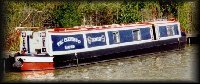
Looking back at Ramsey. High Lode. Middle Level.

Bill Fen Marina. Ramsey. High Lode. Middle Level.

The stop gate protected Bill Fen Marina. Ramsey. High Lode. Middle
Level.
![]()
Leaving Bill Fen Marina. Ramsey. High Lode. Middle Level.
![]()
Back at the junction with the River Nene Old Course. High Lode. Middle
Level.

Lodes End Lock. River Nene Old Course. Middle Level.

Lodes End Lock. River Nene Old Course. Middle Level.

Lodes End Lock. River Nene Old Course. Middle Level.

Leaving Lodes End Lock. River Nene Old Course. Middle Level.
![]()
Green Hall Bridge. River Nene Old Course. Middle Level.
![]()
River Nene Old Course. Middle Level.

Ramsey St Mary's - B1040 Bridge. River Nene Old Course. Middle Level.

Leaving Ramsey St Mary's - B1040 Bridge. River Nene Old Course. Middle
Level.

River Nene Old Course. Middle Level.
![]()
River Nene Old Course. Nightingales Corner. Middle Level.

River Nene Old Course. Approaching the B660 Exhibition Bridge. Middle Level.
![]()
River Nene Old Course. Exhibition Bridge. Middle Level.

River Nene Old Course. Creeping under Exhibition Bridge - is that tight or
what! Middle Level.

River Nene Old Course. Creeping under Exhibition Bridge. Middle Level.

River Nene Old Course. Creeping under Exhibition Bridge. Middle Level.

River Nene Old Course. Creeping under Exhibition Bridge. Note the nail
tiller pin! Middle Level.

River Nene Old Course. We have emerged from under Exhibition Bridge. Middle
Level.
![]()
River Nene Old Course. Old Decoy Farm and pumping station. Middle Level.
![]()
Lower section of Bevill's Leam - Bevill's Leam pumping station. Middle
Level.

Lower section of Bevill's Leam - Bevill's Leam pumping station. Middle
Level.

Lower section of Bevill's Leam - Farcet Fen pumping station. Middle Level.
![]()
Starting up The North Western Cut. Middle Level.
![]()
Looking back at the lower section of Bevill's Leam - straight back and Old
Course of the River Nene - to the the right. Middle Level.

The North Western Cut. Frog Hall Bridge. Middle Level.

The North Western Cut has become Black Ham. Middle Level.

The North Western Cut. ECML railbridge and Yaxley in the distance.
Middle Level.
![]()
After the ECML railbridge the North Western Cut becomes Yaxley Lode. Middle
Level.

Yaxley Lode. The end of navigation at this footbridge / weir. Yaxley. Yards
End Dyke (left) and Pig Water (right) beyond. Pig Water is basically the Old
Course of the River Nene and comes out (via another weir) on Kings Dyke, just
beyond Stanground. Middle Level.

Yaxley Lode. The end of navigation at this footbridge / weir. Yaxley. Middle
Level.

Yaxley Lode - looking back down. Yaxley. Middle Level.

Yaxley Lode. The end of navigation at this footbridge / weir. Backing out.
Yaxley. Middle Level.
![]()
Starting along New Dyke. Middle Level.

Junction with Great Raveley Drain to left. New Dyke. Middle Level.

New Dyke. Charterhouse Farm Bridge. Middle Level.

New Dyke - getting narrower. Middle Level.

New Dyke - looking back. Middle Level.

New Dyke - the end - ECML bridge just visible. Middle Level.

New Dyke - the end - reversing back to the nice mooring and winding point.
Middle Level.

New Dyke - the end - winding point. Middle Level.

New Dyke - the end - winding point. Middle Level.

New Dyke - extraction. Middle Level.

New Dyke - extraction. Middle Level.

New Dyke - extraction. Middle Level.

New Dyke - the old head of navigation - the drain by Top Farm. Middle Level.

Looking back after having started up Monk's Lode. Middle Level.
![]()
Looking up Monk's Lode. Middle Level.

Looking up Monk's Lode. Middle Level.

Looking back down Monk's Lode - we have decided to get to Eternity Hall farm
Bridge! Middle Level.

Looking back down Monk's Lode - we have decided to get to Eternity Hall farm
Bridge! Middle Level.

Monk's Lode. Eternity Hall farm Bridge. Middle Level.

Monk's Lode. looking back from Eternity Hall farm Bridge. Middle Level.

Monk's Lode. Eternity Hall farm Bridge - it was just doable. Middle Level.

Monk's Lode. Eternity Hall farm Bridge. Middle Level.

Monk's Lode. Nearly back to the pumping station. Middle Level.

Starting up Great Raveley Drain. Middle Level.

Great Raveley Drain. Middle Level.

Great Raveley Drain. Middle Level.

Great Raveley Drain - control sluice. Middle Level.

Great Raveley Drain - control sluice. Middle Level.

Great Raveley Drain - we have made it under the control sluice. Middle
Level.

Great Raveley Drain - stopped by the bridge to Woodwalton Fen Nature
Reserve. Middle Level.

Ramsey Forty Foot Bridge. Ramsey Forty Foot Drain. Middle Level.
Home Page | "Earnest" | "Beatty" | Canal Restoration